Area Overview for TA21 9LL
Photos of TA21 9LL
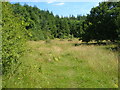
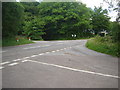
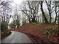
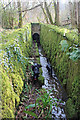


36 photos from this area
Area Information
Key information about the TA21 9LL including its size, population, and administrative classification.
- Area Type
- Postcode
- Area Size
- 1.9 km²
- Population
- 2180
- Population Density
- 61 people/km²
House Prices in TA21 9LL
11
Properties
£774,333
Average Sold Price
£520,000
Lowest Price
£1,150,000
Highest Price
Showing 11 properties
| Address | Type | Beds | Baths | Last Sale Price | Last Sale Date | |
|---|---|---|---|---|---|---|
| Higher Ruggin Farm, Ruggin Road, West Buckland, Wellington, TA21 9LL | Bungalow | 4 | 3 | £1,150,000 | Mar 2021 | |
| Higher Ruggin House, Ruggin Road, West Buckland, Wellington, TA21 9LL | Detached | 3 | 4 | £520,000 | Sep 2015 | |
| Farmwood Cottage, Ruggin Road, West Buckland, Wellington, TA21 9LL | Land | 4 | 3 | £653,000 | Jun 2015 | |
| Hazelbrook, Ruggin Road, West Buckland, Wellington, TA21 9LL | Retail | - | - | - | - | |
| The Bungalow, Ruggin Road, West Buckland, Wellington, TA21 9LL | undefined | - | - | - | - | |
| Hill Farm, Ruggin Road, West Buckland, Wellington, TA21 9LL | Detached | - | - | - | - | |
| Melcombe, Ruggin Road, West Buckland, Wellington, TA21 9LL | Detached | - | - | - | - | |
| Annexe, Monksway, Ruggin Road, West Buckland, Wellington, TA21 9LL | Detached | - | - | - | - | |
| Lower Ruggin Farm, Ruggin Road, West Buckland, Wellington, TA21 9LL | Detached | - | - | - | - | |
| Marigold Cottage, Ruggin Road, West Buckland, Wellington, TA21 9LL | Bungalow | - | - | - | - |
Page 1 of 2
Energy Efficiency in TA21 9LL
Amenities
Schools
| Rank | School | Type | Entry gender | Ages |
|---|
Explore more schools in this area
Go to Schools tabDemographics
Household Size
Two person
most common
Accommodation Type
Houses
most common
Tenure
83
majority
Ethnic Group
White
most common
Religion
N/A
most common
Household Composition
N/A
most common
Age
47
median
Adults (30-64 years)
most common
Household Deprivation
N/A
with no deprivation
NS-SEC
38
in Lower managerial occupations
Explore more demographic insights in this area
Go to Demographics tabPlanning
Planning Constraints
- Flood RiskPremium
- Ramsar Wetland SitesPremium
- Area of Outstanding Natural BeautyPremium
- Protected Nature ReservePremium
- Protected WoodlandPremium