Area Overview for DT8 3BT
Photos of DT8 3BT

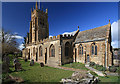
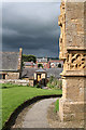
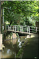
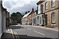
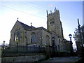
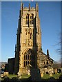
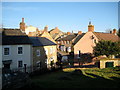
100 photos from this area
Area Information
Key information about the DT8 3BT including its size, population, and administrative classification.
- Area Type
- Postcode
- Area Size
- 4.1 hectares
- Population
- 1394
- Population Density
- 340 people/km²
House Prices in DT8 3BT
21
Properties
£319,722
Average Sold Price
£162,500
Lowest Price
£401,000
Highest Price
Showing 21 properties
| Address | Type | Beds | Baths | Last Sale Price | Last Sale Date | |
|---|---|---|---|---|---|---|
| 16 Monmouth Gardens, Beaminster, DT8 3BT | Bungalow | 2 | 2 | £401,000 | Oct 2023 | |
| 10 Monmouth Gardens, Beaminster, DT8 3BT | Semi-detached | 4 | 1 | £385,000 | Jul 2023 | |
| 7 Monmouth Gardens, Beaminster, DT8 3BT | Bungalow | 2 | 1 | £350,000 | Jun 2020 | |
| 21 Monmouth Gardens, Beaminster, DT8 3BT | Detached | 3 | 2 | £385,000 | Aug 2018 | |
| 17 Monmouth Gardens, Beaminster, DT8 3BT | Bungalow | 3 | - | £370,000 | Sep 2016 | |
| 18 Monmouth Gardens, Beaminster, DT8 3BT | Bungalow | 3 | - | £364,000 | Jan 2016 | |
| 20 Monmouth Gardens, Beaminster, DT8 3BT | Bungalow | - | - | £260,000 | Jul 2012 | |
| 14 Monmouth Gardens, Beaminster, DT8 3BT | Bungalow | - | - | £200,000 | May 2003 | |
| 15 Monmouth Gardens, Beaminster, DT8 3BT | Detached | - | - | £162,500 | Oct 2001 | |
| 8 Monmouth Gardens, Beaminster, DT8 3BT | Retail | 3 | 1 | - | - |
Page 1 of 3
Energy Efficiency in DT8 3BT
Amenities
Schools
| Rank | School | Type | Entry gender | Ages |
|---|
Explore more schools in this area
Go to Schools tabDemographics
Household Size
Two person
most common
Accommodation Type
Houses
most common
Tenure
73
majority
Ethnic Group
White
most common
Religion
N/A
most common
Household Composition
N/A
most common
Age
47
median
Elderly (65+ years)
most common
Household Deprivation
N/A
with no deprivation
NS-SEC
34
in Lower managerial occupations
Explore more demographic insights in this area
Go to Demographics tabPlanning
Planning Constraints
- Flood RiskPremium
- Ramsar Wetland SitesPremium
- Area of Outstanding Natural BeautyPremium
- Protected Nature ReservePremium
- Protected WoodlandPremium