Area Overview for DT8 3SP
Photos of DT8 3SP
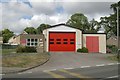

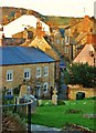
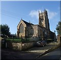
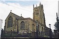
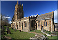

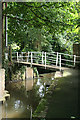
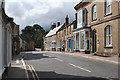
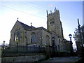
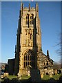
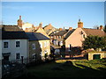
100 photos from this area
Area Information
Key information about the DT8 3SP including its size, population, and administrative classification.
- Area Type
- Postcode
- Area Size
- 1.2 hectares
- Population
- 1394
- Population Density
- 340 people/km²
House Prices in DT8 3SP
33
Properties
£220,125
Average Sold Price
£49,000
Lowest Price
£440,000
Highest Price
Showing 33 properties
| Address | Type | Beds | Baths | Last Sale Price | Last Sale Date | |
|---|---|---|---|---|---|---|
| 25A Windy Ridge, Beaminster, DT8 3SP | Terraced | 2 | 1 | £223,000 | Oct 2024 | |
| 7 Windy Ridge, Beaminster, DT8 3SP | Retail | 4 | 2 | £387,000 | Apr 2023 | |
| 29 Windy Ridge, Beaminster, DT8 3SP | Terraced | 1 | 1 | £186,000 | Feb 2023 | |
| 23A Windy Ridge, Beaminster, DT8 3SP | Terraced | 2 | 1 | £210,000 | Nov 2021 | |
| 45 Windy Ridge, Beaminster, DT8 3SP | Bungalow | 3 | 2 | £385,000 | Jun 2021 | |
| 27A Windy Ridge, Beaminster, DT8 3SP | Terraced | 2 | 1 | £185,000 | Mar 2021 | |
| 3 Windy Ridge, Beaminster, DT8 3SP | Detached | 4 | - | £410,000 | Mar 2021 | |
| 55 Windy Ridge, Beaminster, DT8 3SP | Detached | 4 | 2 | £440,000 | Aug 2020 | |
| 19 Windy Ridge, Beaminster, DT8 3SP | Terraced | 3 | 1 | £197,000 | Dec 2018 | |
| 41 Windy Ridge, Beaminster, DT8 3SP | Detached | 4 | 2 | £420,000 | Nov 2017 |
Page 1 of 4
Energy Efficiency in DT8 3SP
Amenities
Schools
| Rank | School | Type | Entry gender | Ages |
|---|
Explore more schools in this area
Go to Schools tabDemographics
Household Size
Two person
most common
Accommodation Type
Houses
most common
Tenure
73
majority
Ethnic Group
White
most common
Religion
N/A
most common
Household Composition
N/A
most common
Age
47
median
Elderly (65+ years)
most common
Household Deprivation
N/A
with no deprivation
NS-SEC
34
in Lower managerial occupations
Explore more demographic insights in this area
Go to Demographics tabPlanning
Planning Constraints
- Flood RiskPremium
- Ramsar Wetland SitesPremium
- Area of Outstanding Natural BeautyPremium
- Protected Nature ReservePremium
- Protected WoodlandPremium