Area Overview for BS7 9PR
Photos of BS7 9PR


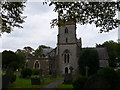
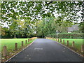
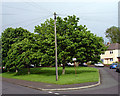
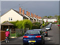
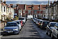
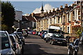
100 photos from this area
Area Information
Key information about the BS7 9PR including its size, population, and administrative classification.
- Area Type
- Postcode
- Area Size
- 8079 m²
- Population
- 2129
- Population Density
- 8945 people/km²
House Prices in BS7 9PR
39
Properties
£283,052
Average Sold Price
£67,500
Lowest Price
£488,500
Highest Price
Showing 39 properties
| Address | Type | Beds | Baths | Last Sale Price | Last Sale Date | |
|---|---|---|---|---|---|---|
| 107 Downend Road, Horfield, Bristol, BS7 9PR | Semi-detached | 3 | 2 | £488,500 | Apr 2025 | |
| 61 Downend Road, Horfield, Bristol, BS7 9PR | Terraced | 2 | 2 | £365,000 | Mar 2025 | |
| 51 Downend Road, Horfield, Bristol, BS7 9PR | Terraced | 2 | 2 | £380,000 | Oct 2024 | |
| 57 Downend Road, Horfield, Bristol, BS7 9PR | Terraced | 2 | 1 | £431,000 | Aug 2024 | |
| 105A Downend Road, Horfield, Bristol, BS7 9PR | Terraced | 2 | 1 | £413,000 | Jun 2024 | |
| 83 Downend Road, Horfield, Bristol, BS7 9PR | Terraced | 2 | 1 | £453,500 | Jul 2023 | |
| 81 Downend Road, Horfield, Bristol, BS7 9PR | Terraced | 2 | 1 | £407,000 | Mar 2022 | |
| 49 Downend Road, Horfield, Bristol, BS7 9PR | house | - | - | £380,000 | Jun 2021 | |
| 55 Downend Road, Horfield, Bristol, BS7 9PR | Terraced | 2 | 1 | £365,000 | Jun 2020 | |
| 59 Downend Road, Horfield, Bristol, BS7 9PR | Terraced | 3 | 2 | £420,000 | Jul 2019 |
Page 1 of 4
Energy Efficiency in BS7 9PR
Amenities
Schools
| Rank | School | Type | Entry gender | Ages |
|---|
Explore more schools in this area
Go to Schools tabDemographics
Household Size
Family (3-5 people)
most common
Accommodation Type
Houses
most common
Tenure
70
majority
Ethnic Group
White
most common
Religion
N/A
most common
Household Composition
N/A
most common
Age
47
median
Adults (30-64 years)
most common
Household Deprivation
N/A
with no deprivation
NS-SEC
48
in Lower managerial occupations
Explore more demographic insights in this area
Go to Demographics tabPlanning
Planning Constraints
- Flood RiskPremium
- Ramsar Wetland SitesPremium
- Area of Outstanding Natural BeautyPremium
- Protected Nature ReservePremium
- Protected WoodlandPremium