Area Overview for BS7 9QJ
Photos of BS7 9QJ


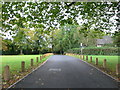
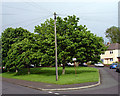
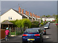

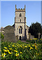

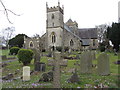
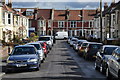
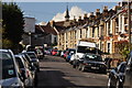
100 photos from this area
Area Information
Key information about the BS7 9QJ including its size, population, and administrative classification.
- Area Type
- Postcode
- Area Size
- 1.2 hectares
- Population
- 2129
- Population Density
- 8945 people/km²
House Prices in BS7 9QJ
42
Properties
£319,072
Average Sold Price
£20,000
Lowest Price
£605,500
Highest Price
Showing 42 properties
| Address | Type | Beds | Baths | Last Sale Price | Last Sale Date | |
|---|---|---|---|---|---|---|
| 70 Strathmore Road, Horfield, Bristol, BS7 9QJ | house | 3 | 1 | £535,000 | Oct 2024 | |
| 18 Strathmore Road, Horfield, Bristol, BS7 9QJ | house | 3 | 2 | £470,000 | Sep 2024 | |
| 60 Strathmore Road, Horfield, Bristol, BS7 9QJ | Terraced | 3 | 1 | £480,000 | Dec 2023 | |
| 52 Strathmore Road, Horfield, Bristol, BS7 9QJ | Terraced | 3 | 2 | £490,000 | Aug 2023 | |
| 20 Strathmore Road, Horfield, Bristol, BS7 9QJ | Terraced | 3 | 1 | £470,000 | Jan 2023 | |
| 4 Strathmore Road, Horfield, Bristol, BS7 9QJ | house | 3 | 2 | £605,500 | Jan 2023 | |
| 74 Strathmore Road, Horfield, Bristol, BS7 9QJ | Retail | 3 | 1 | £449,000 | Sep 2022 | |
| 46 Strathmore Road, Horfield, Bristol, BS7 9QJ | house | 4 | 1 | £565,000 | Feb 2022 | |
| 58 Strathmore Road, Horfield, Bristol, BS7 9QJ | Terraced | 3 | 1 | £463,000 | May 2021 | |
| 30 Strathmore Road, Horfield, Bristol, BS7 9QJ | house | - | - | £475,000 | Apr 2021 |
Page 1 of 5
Energy Efficiency in BS7 9QJ
Amenities
Schools
| Rank | School | Type | Entry gender | Ages |
|---|
Explore more schools in this area
Go to Schools tabDemographics
Household Size
Family (3-5 people)
most common
Accommodation Type
Houses
most common
Tenure
70
majority
Ethnic Group
White
most common
Religion
N/A
most common
Household Composition
N/A
most common
Age
47
median
Adults (30-64 years)
most common
Household Deprivation
N/A
with no deprivation
NS-SEC
48
in Lower managerial occupations
Explore more demographic insights in this area
Go to Demographics tabPlanning
Planning Constraints
- Flood RiskPremium
- Ramsar Wetland SitesPremium
- Area of Outstanding Natural BeautyPremium
- Protected Nature ReservePremium
- Protected WoodlandPremium