Area Overview for BS48 4YS
Photos of BS48 4YS
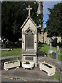
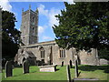
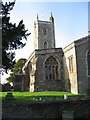
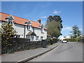
26 photos from this area
Area Information
Key information about the BS48 4YS including its size, population, and administrative classification.
- Area Type
- Postcode
- Area Size
- 1.7 hectares
- Population
- Not available
- Population Density
- Not available
House Prices in BS48 4YS
21
Properties
£302,747
Average Sold Price
£170,000
Lowest Price
£485,000
Highest Price
Showing 21 properties
| Address | Type | Beds | Baths | Last Sale Price | Last Sale Date | |
|---|---|---|---|---|---|---|
| 51 White Oak Way, Nailsea, BS48 4YS | house | - | - | £405,000 | Sep 2021 | |
| 33 White Oak Way, Nailsea, BS48 4YS | Bungalow | - | - | £485,000 | Aug 2019 | |
| 49 White Oak Way, Nailsea, BS48 4YS | Semi-detached | 3 | 1 | £268,500 | Nov 2015 | |
| 29 White Oak Way, Nailsea, BS48 4YS | Bungalow | 4 | 2 | £425,000 | Nov 2015 | |
| 47 White Oak Way, Nailsea, BS48 4YS | house | - | - | £283,500 | May 2014 | |
| 31 White Oak Way, Nailsea, BS48 4YS | Bungalow | - | - | £332,500 | Aug 2012 | |
| 35 White Oak Way, Nailsea, BS48 4YS | Detached | 5 | 2 | £250,000 | Apr 2012 | |
| 37 White Oak Way, Nailsea, BS48 4YS | house | 4 | - | £337,000 | Jan 2012 | |
| 21 White Oak Way, Nailsea, BS48 4YS | Detached | - | - | £315,000 | Feb 2009 | |
| 53 White Oak Way, Nailsea, BS48 4YS | Detached | - | - | £212,500 | Apr 2007 |
Page 1 of 3
Energy Efficiency in BS48 4YS
Amenities
Schools
| Rank | School | Type | Entry gender | Ages |
|---|
Explore more schools in this area
Go to Schools tabDemographics
Household Size
Two person
most common
Accommodation Type
Houses
most common
Tenure
77
majority
Ethnic Group
White
most common
Religion
N/A
most common
Household Composition
N/A
most common
Age
47
median
Adults (30-64 years)
most common
Household Deprivation
N/A
with no deprivation
NS-SEC
40
in Lower managerial occupations
Explore more demographic insights in this area
Go to Demographics tabPlanning
Planning Constraints
- Flood RiskPremium
- Ramsar Wetland SitesPremium
- Area of Outstanding Natural BeautyPremium
- Protected Nature ReservePremium
- Protected WoodlandPremium