Area Overview for BS48 4LU
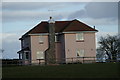
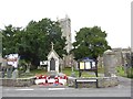
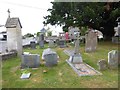
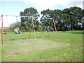
Photos of BS48 4LU
Area Information
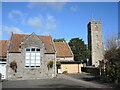
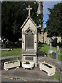
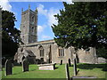
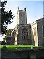
BS48 4LU represents a specific residential cluster within the larger market town of Nailsea in North Somerset. This small area covers 887 square metres and houses a population of 1,472 residents. You are living in a community situated approximately 8 miles southwest of Bristol and 11 miles northeast of Weston-super-Mare. The area lies within the Portbury Hundred under the jurisdiction of North Somerset unitary authority. Nailsea's name may derive from Old English meaning Naegl's island, hinting at a history that stretches back to Roman times when the land was used for sandstone extraction. Daily life here is shaped by the town's deep-rooted industrial past. Coal mining defined the economy from the late 18th century onwards, with Brunel's railway reaching the region in 1841 to facilitate transport. Although mining declined after 1860, the landscape retains evidence of this heritage. The town features significant landmarks such as Holy Trinity Church, dating from the 14th–15th century, and the Elms Colliery, an 18th-century colliery and Scheduled Ancient Monument. For those considering homes in BS48 4LU, the location offers a blend of historic character and modern convenience. The proximity to Bristol and surrounding towns makes it a practical base for commuting while maintaining a connection to local life. You have access to a diverse mix of retail, transport links, and leisure options just beyond your doorstep, allowing for a balanced lifestyle rooted in a rich historical context.
- Area Type
- Postcode
- Area Size
- 887 m²
- Population
- Not available
- Population Density
- Not available
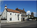
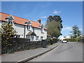
The housing stock in BS48 4LU is defined by a strong preference for private ownership. A full 77% of properties in this small postcode are owned by their occupants, indicating a stable market where long-term residents make up the majority. The predominant accommodation type is listed as houses, which suggests that the area consists of detached, semi-detached, or terraced family homes rather than flats or purpose-built complexes. This housing structure aligns with the mature demographic profile where adults aged 30 to 64 years seek permanent residences. Because almost three-quarters of the population owns their homes, the rental market is likely a small minority option. Buyers should expect a local property market characterised by steady demand from owner-occupiers rather than a high turnover of investment properties or short-term lets. If you are looking at homes in BS48 4LU, you will mostly encounter single-family dwellings with established gardens and interiors suited to traditional living. The dominance of house ownership often stabilises property values and makes the area attractive for families seeking to put down roots. Competition may arise primarily from other buyers with similar financial profiles and intentions, rather than from speculative investors flipping properties quickly. The 23% of non-owner-occupied units likely include a mix of rental properties and freehold homes bought for capital growth, but the overwhelming narrative is one of settled habitation.
House Prices in BS48 4LU
Showing 1 properties
| Address | Type | Beds | Baths | Last Sale Price | Last Sale Date | |
|---|---|---|---|---|---|---|
| 1 Haslands, Nailsea, BS48 4LU | Detached | - | - | £390,000 | Jul 2008 |
Energy Efficiency in BS48 4LU
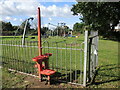
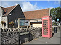
Residents of BS48 4LU enjoy convenient access to a variety of amenities that enhance daily life. Retail options are well represented within a short distance, with five key locations offering goods and services. Notable retailers include Iceland Nailsea, The Southern Co-operative Co, and Waitrose Nailsea, providing everything from grocery shopping to household necessities. This retail density ensures you do not need to travel far for essential items or regular treats. Transport and leisure facilities are equally accessible. Five nearby railway stations offer connectivity, while three ferry landing points including Bristol Docks Ferry Landing and Portishead Pier provide coastal access. Travelers can reach Clevedon Pier for leisure activities or head to Bristol Airport via the two listed airport facilities. These transport links integrate smoothly with local needs. The Coates Estate, formerly the Coates Cider factory, now hosts diverse local and national businesses, adding to the commercial vibrancy. Historical landmarks like Holy Trinity Church and Tyntesfield National Trust property offer cultural and recreational interests. You can combine utility shopping at Waitrose with a trip to nearby attractions, creating a balanced routine. The 1472 residents share this access point to services, ensuring the area remains functional yet retains a suburban feel. Living in BS48 4LU grants you a lifestyle where practical needs are met without sacrificing access to broader regional opportunities.
Amenities
Schools
Families living in BS48 4LU benefit from several educational institutions within practical reach. The area is served by Hannah More Infant School, which operates as an academy for younger children. Nearby options for primary education include Grove Junior School, which also functions as an academy. These institutions provide a comprehensive local education pipeline for residents from early years through to the junior stage. Having both infant and junior schools in close proximity means you can often walk children to school or access education without needing to commute further into Breadalbane, Portbury, or other wider town centres. The presence of two academies indicates that these schools follow the academy model, which often allows for greater autonomy in curriculum and management compared to maintained schools. For those researching schools near BS48 4LU, choice is limited to these specific named institutions in the immediate vicinity. If your family requires secondary education, you would need to look beyond this specific postcode to neighbouring towns. The 100% coverage of named preschool and junior schools suggests a well-served area for young children. This concentration of educational facilities supports the demographic reality that a significant portion of the population consists of adults with school-age children or preparing for retirement. The academy status of both Hannah More Infant School and Grove Junior School reflects a modern approach to education, potentially offering updated facilities and teaching methodologies.
| Rank | School | Type | Entry gender | Ages |
|---|
Explore more schools in this area
Go to Schools tabDemographics
The community in BS48 4LU is predominantly composed of adults between 30 and 64 years of age. The median age for residents is 47, indicating a mature neighbourhood where stability and established roots are common. House ownership stands at a high level of 77%, suggesting that most properties are owner-occupied rather than rental accommodations. This ownership rate typically correlates with long-term residents who have chosen to make the area their home. The prevailing accommodation type consists of houses, which often provide spacious living environments suited for families or multi-generational households. Ethnically, the area is predominantly White, reflecting the broader demographic trends of rural Somerset and the historic nature of the region. With a population density of 1,659,290 people per square kilometre calculated from the total figures, the specific cluster feels intimate and less crowded compared to urban centres. The age profile implies that you are likely buying a home for retirement, a large family needing room, or an investment for the mid-life buyer. The 77% home ownership rate reduces the prevalence of short-term tenants and fosters a more stable neighbourhood atmosphere. Living in BS48 4LU means joining an older cohort of residents who value quiet streets and established communities. The demographic makeup supports a low-energy, settled lifestyle where neighbours often know one another through generations rather than transient tenancies.
Household Size
Accommodation Type
Tenure
Ethnic Group
Religion
Household Composition
Age
Household Deprivation
NS-SEC
Explore more demographic insights in this area
Go to Demographics tabPlanning
Planning Constraints
- Flood RiskPremium
- Ramsar Wetland SitesPremium
- Area of Outstanding Natural BeautyPremium
- Protected Nature ReservePremium
- Protected WoodlandPremium