Area Overview for BS41 9HA
Photos of BS41 9HA
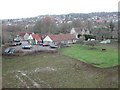
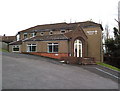
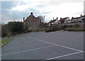
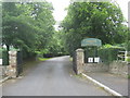
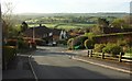
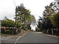
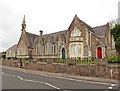
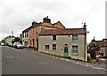
46 photos from this area
Area Information
Key information about the BS41 9HA including its size, population, and administrative classification.
- Area Type
- Postcode
- Area Size
- 9790 m²
- Population
- 1809
- Population Density
- 220 people/km²
House Prices in BS41 9HA
18
Properties
£613,139
Average Sold Price
£311,000
Lowest Price
£1,050,000
Highest Price
Showing 18 properties
| Address | Type | Beds | Baths | Last Sale Price | Last Sale Date | |
|---|---|---|---|---|---|---|
| 94 Ridgeway Road, Long Ashton, BS41 9HA | Semi-detached | 3 | 1 | £1,050,000 | Mar 2025 | |
| 84 Ridgeway Road, Long Ashton, BS41 9HA | house | 4 | 2 | £890,250 | Oct 2022 | |
| 82 Ridgeway Road, Long Ashton, BS41 9HA | house | - | - | £705,000 | Mar 2022 | |
| 86 Ridgeway Road, Long Ashton, BS41 9HA | house | 4 | 2 | £690,000 | May 2017 | |
| 104 Ridgeway Road, Long Ashton, BS41 9HA | Semi-detached | 3 | 1 | £502,000 | Oct 2015 | |
| 80 Ridgeway Road, Long Ashton, BS41 9HA | Semi-detached | 4 | - | £470,000 | Nov 2014 | |
| 88 Ridgeway Road, Long Ashton, BS41 9HA | Detached | 4 | - | £490,000 | Oct 2013 | |
| 76 Ridgeway Road, Long Ashton, BS41 9HA | Semi-detached | - | - | £410,000 | May 2007 | |
| 100 Ridgeway Road, Long Ashton, BS41 9HA | Semi-detached | - | - | £311,000 | Sep 2005 | |
| 74 Ridgeway Road, Long Ashton, BS41 9HA | Semi-detached | 3 | 1 | - | - |
Page 1 of 2
Energy Efficiency in BS41 9HA
Amenities
Schools
| Rank | School | Type | Entry gender | Ages |
|---|
Explore more schools in this area
Go to Schools tabDemographics
Household Size
Two person
most common
Accommodation Type
Houses
most common
Tenure
91
majority
Ethnic Group
White
most common
Religion
N/A
most common
Household Composition
N/A
most common
Age
47
median
Adults (30-64 years)
most common
Household Deprivation
N/A
with no deprivation
NS-SEC
55
in Lower managerial occupations
Explore more demographic insights in this area
Go to Demographics tabPlanning
Planning Constraints
- Flood RiskPremium
- Ramsar Wetland SitesPremium
- Area of Outstanding Natural BeautyPremium
- Protected Nature ReservePremium
- Protected WoodlandPremium