Area Overview for BS18 9DE
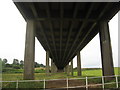
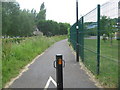
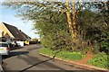
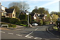
Photos of BS18 9DE
Area Information
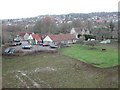
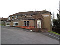
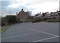
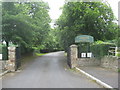
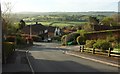
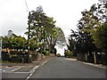
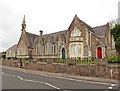
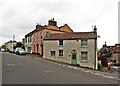
BS18 9DE lies in the small residential cluster of Long Ashton, a village with roots stretching back to Saxon times and recorded in the Domesday Book as Estune. Nestled near Bristol, it borders ancient parishes like Bedminster and Dundry, with the River Avon nearby. The area’s compact population of 1,809 residents, spread across 220 people per square kilometre, reflects a tight-knit community. Its layout follows the main road for nearly two miles, flanked by brooks like Longmoor Brook. Long Ashton’s history is etched in its landmarks, from the 14th-century All Saints Church to the historic Ashton Court Estate. Living here means proximity to Bristol’s amenities without the city’s density, offering a blend of rural charm and commuter convenience. The village’s character is defined by its straggling layout, ancient boundaries, and a population skewed toward middle-aged homeowners. It’s a place where heritage meets practicality, with modern connectivity and low crime rates enhancing its appeal for those seeking a stable, community-focused lifestyle.
- Area Type
- Postcode
- Area Size
- Not available
- Population
- 1809
- Population Density
- 220 people/km²
The property market in BS18 9DE is dominated by owner-occupied homes, with 91% of residents living in houses. This high rate of home ownership suggests a community prioritising long-term investment over rental properties, which is typical of smaller, rural areas. The prevalence of houses, rather than apartments or flats, reflects the area’s low density and historical development patterns. Given the small population and compact footprint, the housing stock is limited, making the market relatively niche. Buyers should expect a focus on traditional properties, possibly with larger gardens, given the rural setting. The lack of high-rise or modern developments means the area appeals to those seeking a quieter, more established environment. However, the limited supply may mean fewer options for buyers, requiring a targeted search within the immediate vicinity.
House Prices in BS18 9DE
No properties found in this postcode.
Energy Efficiency in BS18 9DE
Living in BS18 9DE offers access to a range of practical amenities within reach. Retail options include Co-op Long, Sainsburys Winterstoke, and Iceland South Bristol Retail, providing everyday shopping needs. The nearby ferry landings—Nova Scotia, Cottage, and Pumphouse—add to the area’s connectivity, particularly for those near waterways. Rail stations like Parson Street, Bedminster, and Clifton Down offer direct links to Bristol’s transport network, facilitating commuting or weekend trips. The proximity to Bristol Airport ensures easy travel for residents needing flights. While the area’s small size means fewer large-scale leisure facilities, its location near Bristol opens up access to the city’s cultural and commercial hubs. The mix of retail, transport, and travel options supports a lifestyle that balances local convenience with broader opportunities.
Amenities
Schools
| Rank | School | Type | Entry gender | Ages |
|---|
Explore more schools in this area
Go to Schools tabDemographics
The population of BS18 9DE has a median age of 47, with the majority of residents falling in the 30-64 age range. This suggests a mature, settled community, likely with established careers and families. Home ownership is exceptionally high at 91%, indicating a strong preference for long-term residency over renting. The predominant accommodation type is houses, which aligns with the area’s rural character and low population density. The predominant ethnic group is White, though no specific diversity statistics are provided. The age profile and ownership figures imply a community focused on stability and continuity, with fewer transient residents. This demographic profile may influence local services and amenities, tailored to the needs of middle-aged homeowners rather than younger or more transient populations. The absence of detailed deprivation data means the area’s quality of life can be inferred from its safety scores and infrastructure.
Household Size
Accommodation Type
Tenure
Ethnic Group
Religion
Household Composition
Age
Household Deprivation
NS-SEC
Explore more demographic insights in this area
Go to Demographics tabPlanning
Planning Constraints
- Flood RiskPremium
- Ramsar Wetland SitesPremium
- Area of Outstanding Natural BeautyPremium
- Protected Nature ReservePremium
- Protected WoodlandPremium