Area Overview for BS31 3DW
Photos of BS31 3DW
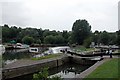
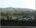
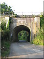
![River Avon below Kelston Lock [No 5] in BS31 3DW](https://images.propbar.co.uk/images/geograph/44/83/4483883_120.jpg)
89 photos from this area
Area Information
Key information about the BS31 3DW including its size, population, and administrative classification.
- Area Type
- Postcode
- Area Size
- 2.6 hectares
- Population
- 1413
- Population Density
- 577 people/km²
House Prices in BS31 3DW
20
Properties
£419,936
Average Sold Price
£197,500
Lowest Price
£735,000
Highest Price
Showing 20 properties
| Address | Type | Beds | Baths | Last Sale Price | Last Sale Date | |
|---|---|---|---|---|---|---|
| 17 Claverton Road, Saltford, BS31 3DW | Bungalow | - | - | £714,500 | Oct 2021 | |
| 39 Claverton Road, Saltford, BS31 3DW | Semi-detached | 3 | 1 | £440,000 | Jun 2021 | |
| 35 Claverton Road, Saltford, BS31 3DW | Semi-detached | 3 | 1 | £420,000 | Mar 2021 | |
| 29 Claverton Road, Saltford, BS31 3DW | Detached | 3 | 1 | £735,000 | Mar 2021 | |
| 31 Claverton Road, Saltford, BS31 3DW | Detached | 4 | 3 | £562,500 | Oct 2020 | |
| 19 Claverton Road, Saltford, BS31 3DW | Detached | 5 | 2 | £645,000 | Nov 2019 | |
| 15 Claverton Road, Saltford, BS31 3DW | Bungalow | - | - | £495,000 | Mar 2015 | |
| 25 Claverton Road, Saltford, BS31 3DW | house | - | - | £270,000 | Jun 2009 | |
| 33 Claverton Road, Saltford, BS31 3DW | house | - | - | £282,000 | Nov 2006 | |
| 9 Claverton Road, Saltford, BS31 3DW | Detached | - | - | £305,000 | Oct 2006 |
Page 1 of 2
Energy Efficiency in BS31 3DW
Amenities
Schools
| Rank | School | Type | Entry gender | Ages |
|---|
Explore more schools in this area
Go to Schools tabDemographics
Household Size
Two person
most common
Accommodation Type
Houses
most common
Tenure
74
majority
Ethnic Group
White
most common
Religion
N/A
most common
Household Composition
N/A
most common
Age
47
median
Adults (30-64 years)
most common
Household Deprivation
N/A
with no deprivation
NS-SEC
45
in Lower managerial occupations
Explore more demographic insights in this area
Go to Demographics tabPlanning
Planning Constraints
- Flood RiskPremium
- Ramsar Wetland SitesPremium
- Area of Outstanding Natural BeautyPremium
- Protected Nature ReservePremium
- Protected WoodlandPremium