Area Overview for BS23 2LU
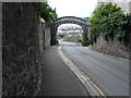
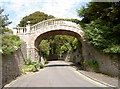
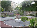
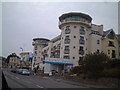
Photos of BS23 2LU

Area Information
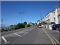
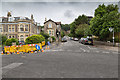
BS23 2LU is a small, densely populated residential cluster in North Somerset, nestled within the historic seaside town of Weston-super-Mare. Covering just 2.7 hectares, this area is home to 1,758 people, translating to a population density of 1,564 people per square kilometre. The postcode lies at the heart of a town that evolved from a 19th-century fishing village into a bustling coastal resort, known for its sandy beaches and Victorian architecture. Daily life here is shaped by proximity to the sea, with the area’s compact size offering easy access to the town’s amenities, including the Grand Pier, promenades, and historic landmarks. Residents benefit from nearby rail connections, including Weston and Worle stations, and a ferry service that links to the mainland. The area’s character is defined by its mix of practical living and coastal charm, making it appealing to those seeking a balance between urban convenience and seaside lifestyle.
- Area Type
- Postcode
- Area Size
- 2.7 hectares
- Population
- 1758
- Population Density
- 1564 people/km²
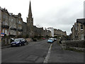
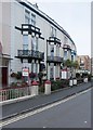
The property market in BS23 2LU is characterised by a low home ownership rate of 48%, suggesting that rental properties dominate the housing stock. The accommodation type is primarily flats, which aligns with the area’s small size and high population density. This configuration indicates a market suited to individuals or couples seeking manageable, centrally located living spaces rather than larger family homes. The prevalence of flats may also reflect the area’s historical development as a resort town, where compact, efficient housing was prioritised. For buyers, this means the available properties are likely to be limited in number and size, with opportunities focused on flats rather than detached or semi-detached homes. The small area’s proximity to amenities and transport links may offset the lack of larger properties, making it attractive to those prioritising convenience over space.
House Prices in BS23 2LU
Showing 62 properties
| Address | Type | Beds | Baths | Last Sale Price | Last Sale Date | |
|---|---|---|---|---|---|---|
| 57 South Road, Weston Super Mare, BS23 2LU | Maisonette | 2 | 1 | £1,225,000 | May 2024 | |
| East Wing, 59 South Road, Weston Super Mare, BS23 2LU | Semi-detached | 6 | 3 | - | - | |
| Flat 7, Seafield Court, 51 South Road, Weston Super Mare, BS23 2LU | Flat | 1 | - | - | - | |
| Flat 5, 59 South Road, Weston Super Mare, BS23 2LU | Flat | 2 | 1 | - | - | |
| Flat 6, Seafield Court, 51 South Road, Weston Super Mare, BS23 2LU | Flat | - | - | - | - | |
| Flat 5, Seafield Court, 51 South Road, Weston Super Mare, BS23 2LU | Flat | - | - | - | - | |
| Flat 2, Seafield Court, 51 South Road, Weston Super Mare, BS23 2LU | Flat | - | - | - | - | |
| Flat 9, Seafield Court, 51 South Road, Weston Super Mare, BS23 2LU | Flat | - | - | - | - | |
| Flat 4, Seafield Court, 51 South Road, Weston Super Mare, BS23 2LU | Flat | - | - | - | - | |
| 1, Holland House, 53 South Road, Weston Super Mare, BS23 2LU | Flat | - | - | - | - |
Energy Efficiency in BS23 2LU
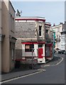
Living in BS23 2LU offers access to a range of local amenities within practical reach. The area is served by five retail outlets, including Spar, Tesco Weston, and Morrisons Daily Weston Super, providing everyday shopping convenience. A ferry service connects residents to the mainland, while three rail stations—Weston, Weston Milton, and Worle—offer regular services to nearby destinations. The proximity to Weston-super-Mare’s seafront means residents can enjoy the town’s historic promenades, Victorian architecture, and the Grand Pier. The compact nature of the area ensures that essential services are close, though the focus on retail and transport suggests a practical, rather than leisure-oriented, lifestyle. For those seeking a mix of convenience and coastal living, the combination of shops, transport links, and proximity to the sea creates a balanced daily environment.
Amenities
Schools
| Rank | School | Type | Entry gender | Ages |
|---|
Explore more schools in this area
Go to Schools tabDemographics
The population of BS23 2LU has a median age of 47, with the largest age group falling between 30 and 64 years. This suggests a community of middle-aged and older residents, many of whom may be established professionals or retirees. Home ownership in the area is relatively low, at 48%, indicating that a significant portion of the housing stock is rented. The predominant accommodation type is flats, reflecting the area’s compact nature and likely influence of multi-unit developments. The predominant ethnic group is White, though specific data on diversity is not provided. The high population density—1,564 people per square kilometre—means the area is closely packed, which can influence community dynamics and the availability of private space. This density also underscores the need for efficient local services and transport links to meet the needs of a concentrated population.
Household Size
Accommodation Type
Tenure
Ethnic Group
Religion
Household Composition
Age
Household Deprivation
NS-SEC
Explore more demographic insights in this area
Go to Demographics tabPlanning
Planning Constraints
- Flood RiskPremium
- Ramsar Wetland SitesPremium
- Area of Outstanding Natural BeautyPremium
- Protected Nature ReservePremium
- Protected WoodlandPremium