Area Overview for BS21 6TP
Photos of BS21 6TP
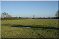
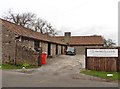
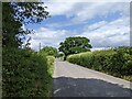

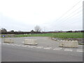

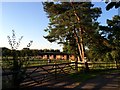
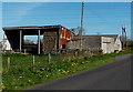
23 photos from this area
Area Information
Key information about the BS21 6TP including its size, population, and administrative classification.
- Area Type
- Postcode
- Area Size
- 25.9 hectares
- Population
- 1732
- Population Density
- 91 people/km²
House Prices in BS21 6TP
27
Properties
£389,688
Average Sold Price
£79,000
Lowest Price
£600,000
Highest Price
Showing 27 properties
| Address | Type | Beds | Baths | Last Sale Price | Last Sale Date | |
|---|---|---|---|---|---|---|
| Downscote, Duck Lane, Kenn, BS21 6TP | Detached | 4 | 2 | £570,000 | Jul 2024 | |
| Willow Cottage, Duck Lane, Kenn, BS21 6TP | house | 3 | 4 | £600,000 | Sep 2022 | |
| Manesty, Duck Lane, Kenn, BS21 6TP | Bungalow | - | - | £560,000 | Sep 2021 | |
| Peartree Cottage, Duck Lane, Kenn, BS21 6TP | Semi-detached | 4 | 2 | £440,000 | Aug 2019 | |
| Honeymead, Duck Lane, Kenn, BS21 6TP | Bungalow | 3 | 1 | £380,000 | May 2016 | |
| Mead Cottage, Duck Lane, Kenn, BS21 6TP | Detached | 3 | 2 | £482,500 | Feb 2016 | |
| Moor View House, Duck Lane, Kenn, BS21 6TP | Detached | 5 | - | £475,000 | Oct 2014 | |
| The Brambles, Duck Lane, Kenn, BS21 6TP | Detached | 5 | - | £580,000 | Sep 2014 | |
| Edgemoor, Duck Lane, Kenn, BS21 6TP | house | - | - | £360,000 | Feb 2011 | |
| Somerset Cottage, Duck Lane, Kenn, BS21 6TP | Terraced | 4 | 2 | £249,950 | Jun 2009 |
Page 1 of 3
Energy Efficiency in BS21 6TP
Amenities
Schools
| Rank | School | Type | Entry gender | Ages |
|---|
Explore more schools in this area
Go to Schools tabDemographics
Household Size
Two person
most common
Accommodation Type
Houses
most common
Tenure
78
majority
Ethnic Group
White
most common
Religion
N/A
most common
Household Composition
N/A
most common
Age
47
median
Adults (30-64 years)
most common
Household Deprivation
N/A
with no deprivation
NS-SEC
38
in Lower managerial occupations
Explore more demographic insights in this area
Go to Demographics tabPlanning
Planning Constraints
- Flood RiskPremium
- Ramsar Wetland SitesPremium
- Area of Outstanding Natural BeautyPremium
- Protected Nature ReservePremium
- Protected WoodlandPremium