Area Overview for BS2 9JE
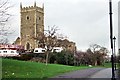
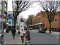
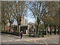
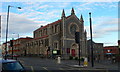
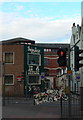
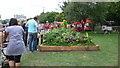
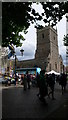
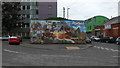
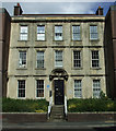
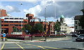
Photos of BS2 9JE


Area Information
Living in BS2 9JE means residing within a compact residential cluster covering just 9,287 square metres. This specific postcode serves 2,689 people, creating a dense urban environment where neighbours are never far away. The area lies in the borough of Bristol, positioning you in a neighbourhood defined by its high population density of 289,537 people per square kilometre. You are situated in an established part of South West England, close to key transport corridors and city amenities. Daily life here is characterised by proximity. With nearly 3,000 residents packed into a small footprint, the area functions as an integrated community unit rather than a sprawling district. The sheer concentration of households influences the local rhythm, offering convenience but also requiring tolerance of higher bustle. This postcode represents a specific section of the wider Bristol urban area, distinct for its small physical size yet significant resident population. You gain immediate access to the wider city network while remaining embedded in this tightly knit residential zone. The compact nature of BS2 9JE means that stepping out of your door places you within reach of major rail stations, supermarkets, and historic city centres that define the Bristol experience.
- Area Type
- Postcode
- Area Size
- 9287 m²
- Population
- Not available
- Population Density
- Not available
Looking at the housing stock in BS2 9JE, you will find a market dominated by rental arrangements. Only 35 per cent of households own their homes, which indicates a dynamic environment where tenancy is the norm for most families and individuals. The vast majority of properties are houses, offering more indoor space than the flats common in other Bristol city centre postcodes. This contrasts with the surrounding urban fabric, which often includes terraced streets and converted buildings. For a buyer targeting this specific postcode, the limited home ownership rate suggests high demand from renters or a shortage of privately sold properties. The area's small size of just over nine thousand square metres reinforces the scarcity of stock. You are likely competing in a tight market where available houses command premium attention due to the high population density of 289,537 people per square kilometre. If you seek to purchase a home here, you must act quickly as the low availability of owner-occupied units on the public market makes finding a purchase a challenging proposition. The presence of mostly houses within such a confined postcode suggests a mix of houses that date back to earlier urban development phases, now adapted to modern rental needs.
House Prices in BS2 9JE
Showing 2 properties
| Address | Type | Beds | Baths | Last Sale Price | Last Sale Date | |
|---|---|---|---|---|---|---|
| St James And St Agnes Nursery School, Halston Drive, St Pauls, Bristol, BS2 9JE | commercial | - | - | - | - | |
| School Bungalow, Halston Drive, St Pauls, Bristol, BS2 9JE | Terraced | - | - | - | - |
Energy Efficiency in BS2 9JE
Your lifestyle in BS2 9JE is defined by immediate access to major retail and transport nodes. You have five retail venues within walking distance, specifically including Tesco Cheltenham, Sainsburys Bristol, and the local Spar in Mina. These three supermarkets ensure you do not need to travel far for groceries, which is convenient given the postcode's small size of 9,287 square metres. Five rail stations are listed as being near your home, including Montpelier and Lawrence Hill, allowing you to reach the wider city centre or suburbs without owning a car. Leisure and transport diversions are also plentiful. Five ferry landings are nearby, including Castle Park Ferry Landing and Temple Bridge Ferry Landing, offering scenic or practical water travel options. You are also close to Bristol Filton Airport, which might be relevant if you sell older electronics or transport light goods via air freight. Two Metrolink-style stops serve the area, located at Bitton and Oldland. This density of amenities means your daily errands can be resolved locally. The combination of Tesco Cheltenham, Sainsburys Bristol, and Spar Mina supports your weekly shopping needs, while the rail and ferry links support your broader mobility requirements. Living here offers a blend of neighbourhood convenience and macro-connectivity.
Amenities
Schools
Families considering homes in BS2 9JE have two local primary school options listed in the immediate vicinity. These include Cabot Primary School and St Barnabas Church of England VC Primary School. Both institutions serve as primary level establishments, providing education for children aged roughly four to ten years old. There are no secondary schools explicitly named in the data for this specific postcode cluster, meaning older students likely travel to larger facilities elsewhere in the Ashley ward or further afield. The mix of these two primary schools offers parents those options within a short distance of their postcode. You will find both a community-run primary institution and a Church of England volatile controlled school, which may influence catchment zones or admissions criteria depending on your faith background. With a median resident age of 47, the area has a significant number of parents of primary school age children. While Cabot Primary School appears twice in the provided records, it confirms the location as a key educational hub for the 2,689 residents living in this dense cluster. If you rely on local schooling, these premises are your primary choice, though you may need to plan carefully regarding transport if secondary education is required outside the immediate BS2 9JE boundaries.
| Rank | School | Type | Entry gender | Ages |
|---|
Explore more schools in this area
Go to Schools tabDemographics
The community in BS2 9JE reflects a mature demographic profile with a median age of 47 years. Most residents fall into the adult age range of 30 to 64 years, suggesting a population that has either settled for long-term family life or is in the middle of their careers. This age distribution indicates stability, with fewer young children or elderly pensioners dominating the household count compared to other ward types. Home ownership stands at 35 per cent, meaning the majority of households in this postcode live in rented properties. Housed predominantly in houses rather than flats, the accommodation type offers more space than typical inner-city studios but within a high-density setting. The predominant ethnic group is White, though the description of the wider Ashley ward notes diversity you may encounter through interaction and local institutions. You are surrounded by adults who have likely established their careers and perhaps raised families during the 30 to 64 year period. This demographic reality shapes local businesses, from specialist grocery stores to family-oriented services, as they cater to a permanent, middle-aged base rather than students or commuters seeking transient housing.
Household Size
Accommodation Type
Tenure
Ethnic Group
Religion
Household Composition
Age
Household Deprivation
NS-SEC
Explore more demographic insights in this area
Go to Demographics tabPlanning
Planning Constraints
- Flood RiskPremium
- Ramsar Wetland SitesPremium
- Area of Outstanding Natural BeautyPremium
- Protected Nature ReservePremium
- Protected WoodlandPremium