Area Overview for BS2 9HT
Photos of BS2 9HT


Area Information
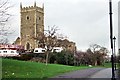
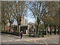
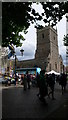
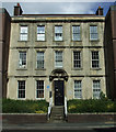
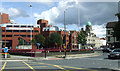
BS2 9HT is a small, tightly knit residential postcode in Bristol, England, with a population of 2,689. Situated northeast of the city centre, it lies near the M32 motorway, offering convenient access to major roads and transport hubs. The area blends historic character with modern amenities, encompassing neighbourhoods like Baptist Mills and Montpelier, known for their cobblestone streets and Napoleonic-era architecture. Daily life here is shaped by a mix of local shops, community initiatives, and proximity to schools and public transport. The ward has undergone gentrification, transforming once-deprived areas into vibrant, culturally diverse spaces. While the population is relatively small, the area’s compact size ensures a strong sense of community. Residents benefit from nearby retail outlets, railway stations, and ferry access, making it a practical choice for those seeking urban living with easy connectivity. The presence of Victorian suburbs and historic sites, such as St Andrew’s Park, adds to its appeal. However, the area’s character is balanced by ongoing challenges, including higher-than-average crime rates, which prospective buyers should consider.
- Area Type
- Postcode
- Area Size
- Not available
- Population
- Not available
- Population Density
- Not available
BS2 9HT’s property market is characterised by a 35% home ownership rate, which is significantly lower than the national average, suggesting a rental-dominated market. The primary accommodation type is houses, though the small postcode area likely limits the availability of larger properties. This dynamic may make owner-occupation less common, with many residents relying on private rentals. The compact size of the area means that buyers must consider proximity to surrounding neighbourhoods for more housing options. The mix of historic and modern properties, including Victorian suburbs and newer developments, offers varied choices, but competition for available homes may be fierce. For buyers, this small postcode’s limited stock could mean higher prices and a need to look beyond immediate surroundings for suitable properties. The rental market’s strength may also influence property values, with potential for appreciation in areas undergoing gentrification.
House Prices in BS2 9HT
No properties found in this postcode.
Energy Efficiency in BS2 9HT
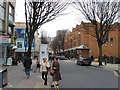
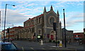
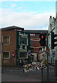
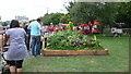
Living in BS2 9HT offers a blend of convenience and character, with amenities such as Sainsburys Bristol, Tesco Cheltenham, and Tesco Bristol providing everyday shopping needs. The area’s proximity to railway stations, including Montpelier and Lawrence Hill, ensures easy access to public transport, while ferry landings like St Philip’s Bridge connect residents to water-based routes. Historic sites such as Baptist Mills and St Andrew’s Park add to the area’s appeal, offering green spaces and cultural heritage. The community is described as creative and alternative, with a strong sense of belonging fostered by local initiatives like the Vocalise community magazine. While the area’s small size limits the range of leisure options, its compact nature encourages walking and cycling. Residents benefit from a mix of retail, transport, and recreational opportunities, making daily life both practical and engaging.
Amenities
Schools
The nearest schools to BS2 9HT include Cabot Primary School and St Barnabas Church of England VC Primary School, both offering primary education. These institutions serve the local community, with two primary schools providing options for families. The presence of two primary schools within close proximity is a practical advantage for parents, reducing travel times and ensuring access to education. However, the data does not specify Ofsted ratings or secondary school options, so further research would be needed to assess the full range of educational facilities. The mix of school types reflects the area’s focus on primary education, which is critical for young families. While no secondary schools are listed, the proximity to Bristol’s broader network of schools may compensate for this gap.
| Rank | School | Type | Entry gender | Ages |
|---|
Explore more schools in this area
Go to Schools tabDemographics
The population of BS2 9HT has a median age of 47, with the majority of residents falling within the 30–64 age range. Home ownership is relatively low at 35%, indicating a rental market dominance. The primary accommodation type is houses, though the small postcode area suggests limited housing stock. The predominant ethnic group is White, but the ward’s diversity is notable, with 33.5% of residents from Black, Asian, and Minority Ethnic backgrounds and 23.8% born outside the UK. This mix contributes to a dynamic community feel. However, the lower home ownership rate may reflect broader trends in urban areas, where rental demand outstrips supply. The absence of specific deprivation data means it is challenging to assess socioeconomic challenges directly, but the ward’s history of gentrification suggests a shift from historically deprived areas to more affluent, middle-class demographics.
Household Size
Accommodation Type
Tenure
Ethnic Group
Religion
Household Composition
Age
Household Deprivation
NS-SEC
Explore more demographic insights in this area
Go to Demographics tabPlanning
Planning Constraints
- Flood RiskPremium
- Ramsar Wetland SitesPremium
- Area of Outstanding Natural BeautyPremium
- Protected Nature ReservePremium
- Protected WoodlandPremium