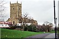
Area Overview for BS2 9HS
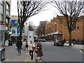
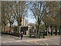
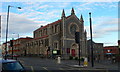
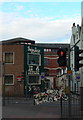
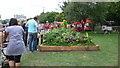
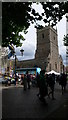
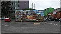
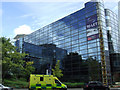
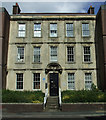
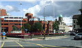
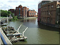
Photos of BS2 9HS
Area Information
BS2 9HS defines a specific postcode cluster within the city of Bristol, encompassing a total residential area of 5,521 square metres. A population of 2,689 people lives within this compact footprint, resulting in an extremely high population density of 487,086 people per square kilometre. This postcode sits in an urban context northeast of the city centre, situated near the M32 motorway. You are likely looking at a dense residential zone where homes are closely packed together. The area functions as a tight-knit residential cluster rather than a sprawling suburb. While the provided data does not specify individual street names for BS2 9HS, the broader Ashley ward context suggests a setting influenced by historic industrial sites like Baptist Mills and planned suburbs such as St Paul's. Living here means navigating a tightly confined neighbourhood with limited open space per capita compared to the wider city. The high density indicates a vibrant, centreliving environment where daily routes are short, but personal space is at a premium. This location offers proximity to major transport arteries while maintaining a distinct residential character defined by its small physical size.
- Area Type
- Postcode
- Area Size
- 5521 m²
- Population
- Not available
- Population Density
- Not available
You are entering a property market defined entirely by houses within the BS2 9HS postcode area. The housing stock comprises exclusively houses, as houses is the only accommodation type listed for this location. This distinction is significant when comparing BS2 9HS to other parts of Bristol that feature semi-detached flats or high-rise living. However, the context of the Ashley ward suggests a mix of historic industrial conversion and Victorian suburbs nearby, which may influence what you find in these houses. Current home ownership stands at 35.7%, indicating that while a substantial minority owns their home, a majority likely rent or belong to shared ownership schemes. This high density of 487,086 people per square kilometre suggests you might encounter terrace houses or closely linked properties rather than detached estates. Prospective buyers looking for standalone properties in BS2 9HS must navigate a space where the vast majority of the 2,689 residents inhabit residential units. The small area size of 5,521 square metres means rare-to-find large plots are unlikely, making every proposition a potential stepping-stone property or a compact option. Understanding that this postcode is a small residential cluster helps frame your expectations regarding privacy and plot size.
House Prices in BS2 9HS
No properties found in this postcode.
Energy Efficiency in BS2 9HS
Life in BS2 9HS centres on immediate access to a variety of retail and leisure facilities located within the broader Ashley ward. Residents have five retail venues available, including Sainsburys Bristol, Tesco Cheltnhm, and Tesco Bristol. These supermarkets provide a complete grocery loop without the need for long car journeys. For rail commutes, five distinct stations including Montpelier Railway Station and Lawrence Hill Railway Station offer direct connections. The area also features five ferry landing spots like St Philip's Bridge and Temple Bridge Ferry Landing, providing alternative transport modes. Five Metro network points in Oldland and Bitton further extend your travel radius. An airport is located nearby in Bristol Filton Airport. While parks and leisure venues are not explicitly detailed by name in the raw amenities list, the broader Ashley context mentions St Andrew's Park and historic sites like Baptist Mills. Living in BS2 9HS offers the convenience of major supermarkets and transport hubs临门. You can rely on Sainsburys Bristol or Tesco Bristol for daily essentials. The proximity to Montpelier Railway Station and Lawrence Hill Railway Station means you can access the wider city without relying solely on roads. Five ferry points and a local airport add layers of connectivity to your daily life.
Amenities
Schools
Families residing in BS2 9HS have access to three identified primary schools within the immediate vicinity. Cabot Primary School serves as one of the key institutions for younger students in the area. St Barnabas Church of England VC Primary School is the second designated primary school option. You will note that Cabot Primary School appears twice in the local registry, suggesting it may serve dual zones or simply holds significant capacity for this demographic. There are no secondary schools explicitly listed in the provided data for BS2 9HS. This absence implies that families often travel to neighboring wards for compulsory secondary education, such as Jesuits College or Thornfield School, which are typically associated with the broader Ashley ward catchment. The concentration of primary schools indicates a neighbourhood with established family infrastructure. When considering schools near BS2 9HS, you must factor in the distance to each campus as the postcode is very small. Cabot Primary School and St Barnabas Church of England VC Primary School form the core of the local education provision. The lack of secondary school data within the specific postcode listing highlights the need to check broader authority catchment areas when planning for older children.
| Rank | School | Type | Entry gender | Ages |
|---|
Explore more schools in this area
Go to Schools tabDemographics
The community in BS2 9HS is dominated by adults, with the most common age range falling between 30 and 64 years. The median age for residents is 47 years old, reflecting a mature demographic profile. You will find that 35% of residents own their homes, meaning the majority of the area consists of rental properties or homes held within investment portfolios. The only accommodation type recorded for this specific postcode is houses, which distinguishes it from London-style flat markets or mixed-use developments. Demographically, the predominant ethnic group is White. This demographic profile suggests a stable, family-oriented population with established roots in the immediate vicinity. The age distribution points towards households that may be combining empty nesters and younger families. With three-quarters of residents being over the age of 30, the social atmosphere revolves around long-term settlement rather than transient populations. High home ownership percentages typically correlate with greater neighbourhood stability and investment in local improvements. The specific composition of houses within a high-density urban setting creates a unique living pattern where floor levels and internal layouts vary significantly from surrounding urban blocks.
Household Size
Accommodation Type
Tenure
Ethnic Group
Religion
Household Composition
Age
Household Deprivation
NS-SEC
Explore more demographic insights in this area
Go to Demographics tabPlanning
Planning Constraints
- Flood RiskPremium
- Ramsar Wetland SitesPremium
- Area of Outstanding Natural BeautyPremium
- Protected Nature ReservePremium
- Protected WoodlandPremium