Area Overview for BS15 3NR
Photos of BS15 3NR
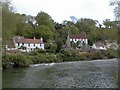


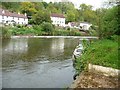
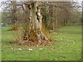
![Lock landing below Hanham Lock [No 1] in BS15 3NR](https://images.propbar.co.uk/images/geograph/44/84/4484440_120.jpg)
100 photos from this area
Area Information
Key information about the BS15 3NR including its size, population, and administrative classification.
- Area Type
- Postcode
- Area Size
- 34.5 hectares
- Population
- 1670
- Population Density
- 1524 people/km²
House Prices in BS15 3NR
19
Properties
£352,417
Average Sold Price
£168,500
Lowest Price
£500,000
Highest Price
Showing 19 properties
| Address | Type | Beds | Baths | Last Sale Price | Last Sale Date | |
|---|---|---|---|---|---|---|
| 104 Abbots Road, Hanham, BS15 3NR | Cottage | 2 | 1 | £360,000 | May 2024 | |
| 82 Abbots Road, Hanham, BS15 3NR | Detached | - | - | £500,000 | Jan 2020 | |
| 80 Abbots Road, Hanham, BS15 3NR | Detached | 5 | - | £400,000 | Sep 2014 | |
| 77 Abbots Road, Hanham, BS15 3NR | Detached | 5 | 1 | £220,000 | Nov 2013 | |
| 98 Abbots Road, Hanham, BS15 3NR | Detached | 4 | 3 | £466,000 | Oct 2006 | |
| 84 Abbots Road, Hanham, BS15 3NR | Detached | - | - | £168,500 | Mar 1998 | |
| 88 Abbots Road, Hanham, BS15 3NR | Bungalow | 2 | 1 | - | - | |
| Tearmallet Limited, Containers, Elm Tree Business Park, 77 Abbots Road, Hanham, BS15 3NR | warehouse | - | - | - | - | |
| 102 Abbots Road, Hanham, BS15 3NR | Semi-detached | - | - | - | - | |
| 72 Abbots Road, Hanham, BS15 3NR | Detached | - | - | - | - |
Page 1 of 2
Energy Efficiency in BS15 3NR
Amenities
Schools
| Rank | School | Type | Entry gender | Ages |
|---|
Explore more schools in this area
Go to Schools tabDemographics
Household Size
Two person
most common
Accommodation Type
Houses
most common
Tenure
80
majority
Ethnic Group
White
most common
Religion
N/A
most common
Household Composition
N/A
most common
Age
47
median
Adults (30-64 years)
most common
Household Deprivation
N/A
with no deprivation
NS-SEC
39
in Lower managerial occupations
Explore more demographic insights in this area
Go to Demographics tabPlanning
Planning Constraints
- Flood RiskPremium
- Ramsar Wetland SitesPremium
- Area of Outstanding Natural BeautyPremium
- Protected Nature ReservePremium
- Protected WoodlandPremium