Area Overview for BS15 3NU
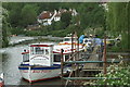
Photos of BS15 3NU
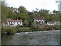

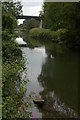
![Lock landing below Hanham Lock [No 1] in BS15 3NU](https://images.propbar.co.uk/images/geograph/44/84/4484440_120.jpg)
100 photos from this area
Area Information
Key information about the BS15 3NU including its size, population, and administrative classification.
- Area Type
- Postcode
- Area Size
- 21.1 hectares
- Population
- 1266
- Population Density
- 1003 people/km²
House Prices in BS15 3NU
10
Properties
£318,000
Average Sold Price
£60,000
Lowest Price
£695,000
Highest Price
Showing 10 properties
| Address | Type | Beds | Baths | Last Sale Price | Last Sale Date | |
|---|---|---|---|---|---|---|
| 3 Hanham Mills, Hanham, BS15 3NU | Terraced | 2 | 1 | £330,000 | Apr 2022 | |
| Picnic House, 5 Hanham Mills, Hanham, BS15 3NU | Detached | - | - | £695,000 | Mar 2021 | |
| Lyndhurst Cottage, Hanham Mills, Hanham, BS15 3NU | house | 3 | 2 | £320,000 | Jul 2013 | |
| 2 Hanham Mills, Hanham, BS15 3NU | Terraced | - | - | £185,000 | May 2002 | |
| The Bungalow, 6 Hanham Mills, Hanham, BS15 3NU | Detached | 2 | - | £60,000 | Oct 1999 | |
| 1 Hanham Mills, Hanham, BS15 3NU | Detached | 5 | - | - | - | |
| The Flat, The Old Lock And Weir, 7 Hanham Mills, Hanham, BS15 3NU | office_workshop | - | - | - | - | |
| 4 Hanham Mills, Hanham, BS15 3NU | Terraced | - | - | - | - | |
| Flat, Chequers Inn, Hanham Mills, Hanham, BS15 3NU | restaurant_cafe | - | - | - | - | |
| Msv Nola, The Old Lock And Weir, 7 Hanham Mills, Hanham, BS15 3NU | Houseboat | - | - | - | - |
Energy Efficiency in BS15 3NU
Amenities
Schools
| Rank | School | Type | Entry gender | Ages |
|---|
Explore more schools in this area
Go to Schools tabDemographics
Household Size
Two person
most common
Accommodation Type
Houses
most common
Tenure
94
majority
Ethnic Group
White
most common
Religion
N/A
most common
Household Composition
N/A
most common
Age
47
median
Adults (30-64 years)
most common
Household Deprivation
N/A
with no deprivation
NS-SEC
36
in Lower managerial occupations
Explore more demographic insights in this area
Go to Demographics tabPlanning
Planning Constraints
- Flood RiskPremium
- Ramsar Wetland SitesPremium
- Area of Outstanding Natural BeautyPremium
- Protected Nature ReservePremium
- Protected WoodlandPremium