Area Overview for BS15 3NJ
Photos of BS15 3NJ
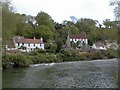
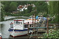
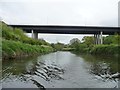
![Lock landing below Hanham Lock [No 1] in BS15 3NJ](https://images.propbar.co.uk/images/geograph/44/84/4484440_120.jpg)
100 photos from this area
Area Information
Key information about the BS15 3NJ including its size, population, and administrative classification.
- Area Type
- Postcode
- Area Size
- 14.8 hectares
- Population
- 1670
- Population Density
- 1524 people/km²
House Prices in BS15 3NJ
24
Properties
£256,847
Average Sold Price
£66,000
Lowest Price
£430,000
Highest Price
Showing 24 properties
| Address | Type | Beds | Baths | Last Sale Price | Last Sale Date | |
|---|---|---|---|---|---|---|
| 20 Castle Farm Road, Hanham, BS15 3NJ | house | - | - | £275,000 | Apr 2022 | |
| 22 Castle Farm Road, Hanham, BS15 3NJ | Semi-detached | 4 | 2 | £342,000 | Sep 2021 | |
| 18 Castle Farm Road, Hanham, BS15 3NJ | Bungalow | 4 | 1 | £430,000 | Jan 2021 | |
| 16 Castle Farm Road, Hanham, BS15 3NJ | Semi-detached | 3 | 1 | £334,000 | Dec 2019 | |
| 8 Castle Farm Road, Hanham, BS15 3NJ | house | - | - | £325,000 | Dec 2017 | |
| The Old Chapel, 11 Castle Farm Road, Hanham, BS15 3NJ | house | - | - | £380,000 | Nov 2014 | |
| 13 Castle Farm Road, Hanham, BS15 3NJ | Semi-detached | 3 | 1 | £258,860 | Jul 2013 | |
| 15A Castle Farm Road, Hanham, BS15 3NJ | Terraced | 2 | - | £200,000 | Aug 2006 | |
| 2 Castle Farm Road, Hanham, BS15 3NJ | house | - | - | £330,000 | Oct 2005 | |
| 6 Castle Farm Road, Hanham, BS15 3NJ | Semi-detached | - | - | £240,000 | Jan 2005 |
Page 1 of 3
Energy Efficiency in BS15 3NJ
Amenities
Schools
| Rank | School | Type | Entry gender | Ages |
|---|
Explore more schools in this area
Go to Schools tabDemographics
Household Size
Two person
most common
Accommodation Type
Houses
most common
Tenure
80
majority
Ethnic Group
White
most common
Religion
N/A
most common
Household Composition
N/A
most common
Age
47
median
Adults (30-64 years)
most common
Household Deprivation
N/A
with no deprivation
NS-SEC
39
in Lower managerial occupations
Explore more demographic insights in this area
Go to Demographics tabPlanning
Planning Constraints
- Flood RiskPremium
- Ramsar Wetland SitesPremium
- Area of Outstanding Natural BeautyPremium
- Protected Nature ReservePremium
- Protected WoodlandPremium