Area Overview for BH9 3QD
Photos of BH9 3QD
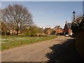
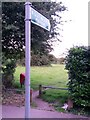
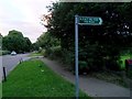
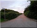
86 photos from this area
Area Information
Key information about the BH9 3QD including its size, population, and administrative classification.
- Area Type
- Postcode
- Area Size
- 7044 m²
- Population
- 1481
- Population Density
- 4160 people/km²
House Prices in BH9 3QD
22
Properties
£188,596
Average Sold Price
£51,000
Lowest Price
£270,000
Highest Price
Showing 22 properties
| Address | Type | Beds | Baths | Last Sale Price | Last Sale Date | |
|---|---|---|---|---|---|---|
| 22 Durweston Close, Bournemouth, BH9 3QD | Semi-detached | 2 | 1 | £270,000 | Oct 2019 | |
| 26 Durweston Close, Bournemouth, BH9 3QD | Semi-detached | 2 | 1 | £232,500 | Feb 2017 | |
| 10 Durweston Close, Bournemouth, BH9 3QD | Terraced | 3 | 1 | £249,950 | Mar 2016 | |
| 28 Durweston Close, Bournemouth, BH9 3QD | Semi-detached | 2 | 1 | £243,500 | Dec 2015 | |
| 14 Durweston Close, Bournemouth, BH9 3QD | Terraced | 3 | 1 | £214,950 | Aug 2015 | |
| 24 Durweston Close, Bournemouth, BH9 3QD | house | - | - | £187,500 | Oct 2013 | |
| 12 Durweston Close, Bournemouth, BH9 3QD | house | - | - | £167,000 | Aug 2012 | |
| 4 Durweston Close, Bournemouth, BH9 3QD | Detached | 3 | 2 | £217,000 | Oct 2010 | |
| 34 Durweston Close, Bournemouth, BH9 3QD | Semi-detached | - | - | £207,250 | Aug 2006 | |
| 8 Durweston Close, Bournemouth, BH9 3QD | house | 3 | 1 | £108,000 | Apr 2002 |
Page 1 of 3
Energy Efficiency in BH9 3QD
Amenities
Schools
| Rank | School | Type | Entry gender | Ages |
|---|
Explore more schools in this area
Go to Schools tabDemographics
Household Size
Family (3-5 people)
most common
Accommodation Type
Houses
most common
Tenure
77
majority
Ethnic Group
White
most common
Religion
N/A
most common
Household Composition
N/A
most common
Age
47
median
Adults (30-64 years)
most common
Household Deprivation
N/A
with no deprivation
NS-SEC
38
in Lower managerial occupations
Explore more demographic insights in this area
Go to Demographics tabPlanning
Planning Constraints
- Flood RiskPremium
- Ramsar Wetland SitesPremium
- Area of Outstanding Natural BeautyPremium
- Protected Nature ReservePremium
- Protected WoodlandPremium