Area Overview for BH9 3LN
Photos of BH9 3LN
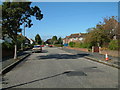
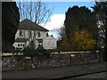
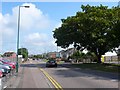
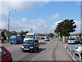
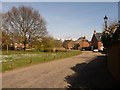
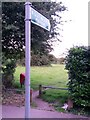
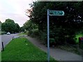
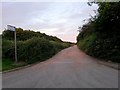
86 photos from this area
Area Information
Key information about the BH9 3LN including its size, population, and administrative classification.
- Area Type
- Postcode
- Area Size
- 1.4 hectares
- Population
- 1748
- Population Density
- 5780 people/km²
House Prices in BH9 3LN
34
Properties
£274,135
Average Sold Price
£55,000
Lowest Price
£380,000
Highest Price
Showing 34 properties
| Address | Type | Beds | Baths | Last Sale Price | Last Sale Date | |
|---|---|---|---|---|---|---|
| 14 Tweedale Road, Bournemouth, BH9 3LN | Semi-detached | 2 | 2 | £295,000 | Oct 2025 | |
| 20 Tweedale Road, Bournemouth, BH9 3LN | Bungalow | 2 | 1 | £380,000 | Dec 2024 | |
| 16 Tweedale Road, Bournemouth, BH9 3LN | house | - | - | £305,000 | Sep 2024 | |
| 18 Tweedale Road, Bournemouth, BH9 3LN | Semi-detached | 3 | 1 | £380,000 | May 2024 | |
| 36 Tweedale Road, Bournemouth, BH9 3LN | Semi-detached | 3 | 1 | £325,000 | Sep 2023 | |
| 38 Tweedale Road, Bournemouth, BH9 3LN | house | - | - | £355,000 | Feb 2023 | |
| 24 Tweedale Road, Bournemouth, BH9 3LN | Semi-detached | 3 | 1 | £358,000 | Jan 2022 | |
| 48 Tweedale Road, Bournemouth, BH9 3LN | Semi-detached | 3 | 1 | £340,000 | Aug 2021 | |
| 42 Tweedale Road, Bournemouth, BH9 3LN | house | - | - | £347,500 | Jun 2021 | |
| 8 Tweedale Road, Bournemouth, BH9 3LN | Semi-detached | 2 | 1 | £278,000 | Jun 2021 |
Page 1 of 4
Energy Efficiency in BH9 3LN
Amenities
Schools
| Rank | School | Type | Entry gender | Ages |
|---|
Explore more schools in this area
Go to Schools tabDemographics
Household Size
Family (3-5 people)
most common
Accommodation Type
Houses
most common
Tenure
70
majority
Ethnic Group
White
most common
Religion
N/A
most common
Household Composition
N/A
most common
Age
47
median
Adults (30-64 years)
most common
Household Deprivation
N/A
with no deprivation
NS-SEC
33
in Lower managerial occupations
Explore more demographic insights in this area
Go to Demographics tabPlanning
Planning Constraints
- Flood RiskPremium
- Ramsar Wetland SitesPremium
- Area of Outstanding Natural BeautyPremium
- Protected Nature ReservePremium
- Protected WoodlandPremium