Area Overview for BH9 3LP
Photos of BH9 3LP
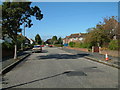
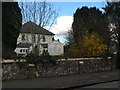
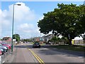
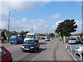
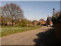
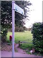
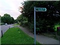
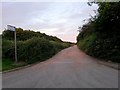
86 photos from this area
Area Information
Key information about the BH9 3LP including its size, population, and administrative classification.
- Area Type
- Postcode
- Area Size
- 1.1 hectares
- Population
- 1748
- Population Density
- 5780 people/km²
House Prices in BH9 3LP
28
Properties
£222,771
Average Sold Price
£68,000
Lowest Price
£375,000
Highest Price
Showing 28 properties
| Address | Type | Beds | Baths | Last Sale Price | Last Sale Date | |
|---|---|---|---|---|---|---|
| 42 Larksfield Avenue, Bournemouth, BH9 3LP | Semi-detached | 3 | 1 | £375,000 | Dec 2024 | |
| 6 Larksfield Avenue, Bournemouth, BH9 3LP | Semi-detached | 3 | 2 | £315,000 | Jun 2024 | |
| 50 Larksfield Avenue, Bournemouth, BH9 3LP | Semi-detached | 3 | 1 | £285,000 | Aug 2023 | |
| 12 Larksfield Avenue, Bournemouth, BH9 3LP | Semi-detached | 3 | 1 | £245,000 | Oct 2017 | |
| 20 Larksfield Avenue, Bournemouth, BH9 3LP | Semi-detached | 3 | 1 | £262,000 | Jun 2017 | |
| 4 Larksfield Avenue, Bournemouth, BH9 3LP | Semi-detached | - | - | £235,250 | Jun 2013 | |
| 52 Larksfield Avenue, Bournemouth, BH9 3LP | house | - | - | £175,000 | Jan 2010 | |
| 40 Larksfield Avenue, Bournemouth, BH9 3LP | Semi-detached | - | - | £195,000 | Sep 2007 | |
| 48 Larksfield Avenue, Bournemouth, BH9 3LP | house | 3 | - | £220,000 | Aug 2007 | |
| 38 Larksfield Avenue, Bournemouth, BH9 3LP | Semi-detached | - | - | £183,000 | Sep 2006 |
Page 1 of 3
Energy Efficiency in BH9 3LP
Amenities
Schools
| Rank | School | Type | Entry gender | Ages |
|---|
Explore more schools in this area
Go to Schools tabDemographics
Household Size
Family (3-5 people)
most common
Accommodation Type
Houses
most common
Tenure
70
majority
Ethnic Group
White
most common
Religion
N/A
most common
Household Composition
N/A
most common
Age
47
median
Adults (30-64 years)
most common
Household Deprivation
N/A
with no deprivation
NS-SEC
33
in Lower managerial occupations
Explore more demographic insights in this area
Go to Demographics tabPlanning
Planning Constraints
- Flood RiskPremium
- Ramsar Wetland SitesPremium
- Area of Outstanding Natural BeautyPremium
- Protected Nature ReservePremium
- Protected WoodlandPremium