Area Overview for Ferring
Photos of Ferring

Area Information
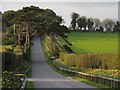
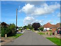
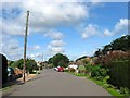
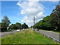
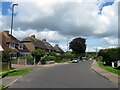
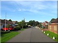
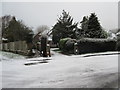
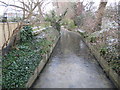
Ferring is a coastal civil parish with a distinct identity within the Arun District of West Sussex. This small community covers an area of 4.1 km² and sits on the A259 road, forming part of the built-up area of Worthing. The village retains its ancient Saxon origins while functioning as a modern holiday destination and residential hub. Historical records mention the settlement from 765 AD, with the Norman parish church of St Andrew still standing on Saxon ruins. Over the decades, farming heritage has blended with post-1920s holiday homes, creating a landscape that mixes rural fields, meadows, and pasture with suburban expansion. Local features include Highdown Hill, which overlooks the village with evidence of ancient fortification, and the historic Ferring Rife stream. You will find manor houses and Georgian architecture amidst these historic settings. The area does not contain large parks or traditional high streets, so daily life revolves around the village centre and nearby Worthing for major amenities. This mix of history and coastal living defines the experience of residing here.
- Area Type
- Parish
- Area Size
- 4.1 km²
- Population
- Not available
- Population Density
- Not available
Demographics
The community profile of Ferring reflects a mature demographic structure suited to established residents. The median age in the parish is 70, indicating a population skewed significantly towards older age groups. Historical data shows that the most common age category provided is simply listed as 'Age: Total', which summarises the entire population rather than isolating younger cohorts. Home ownership stands at 87%, a figure that demonstrates a highly stable tenure model where the vast majority of residents live in their own properties. This high rate of ownership typically correlates with long-term settlement and deep local roots. The data does not provide granular breakdowns for specific accommodations types, ethnic diversity, or religious affiliations, so these specific categories remain unquantified in the available statistics. However, the dominance of owner-occupied homes suggests a community invested in local improvement and stability. When considering dayschools or shops near Ferring, families may face certain limitations due to the area's focus on elderly and retirement demographics alongside historical holiday rentals.
Household Size
Accommodation Type
Tenure
Ethnic Group
Religion
Household Composition
Age
Household Deprivation
NS-SEC
Explore more demographic insights in this area
Go to Demographics tabPlanning
Planning Constraints
- Flood RiskPremium
- Ramsar Wetland SitesPremium
- Area of Outstanding Natural BeautyPremium
- Protected Nature ReservePremium
- Protected WoodlandPremium