Area Overview for Arun District
Photos of Arun District
Area Information
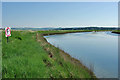
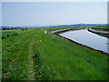
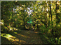
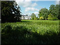
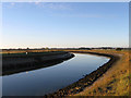
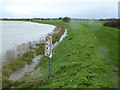
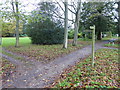
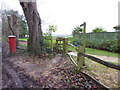
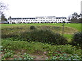
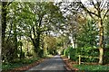
Living in Arun District offers a distinctive experience defined by its dramatic geography and historical depth. This local authority district in West Sussex spans 225.3 km², creating a diverse landscape that ranges from the urban coastal strip to the rolling chalk hills of the South Downs National Park. The River Arun bisects the region, flowing south to the English Channel at Littlehampton, shaping a character that blends seaside resort life with rural tranquility. You can find historic towns like Arundel, home to a castle and cathedral built after the Norman Conquest in 1066, alongside modern seaside communities in Bognor Regis and Littlehampton. These areas feature piers, promenades, and sandy beaches, providing a leisure-focused daily routine for many residents. The district includes open countryside acting as a green gap between main towns, offering access to scenic villages and high-quality agricultural land. Environmental assets such as Sites of Special Scientific Interest and Pagham Harbour Special Protection Area contribute to a significant natural heritage. The northern rural area contains parts of the South Downs National Park, ensuring panoramic views and outdoor activity opportunities. Whether you prefer the bustle of a historic city centre or the quiet of a parish like Aldwick, Angmering, Felpham, or Rustington, Arun District provides varied living environments within a single administrative area.
- Area Type
- District/Borough
- Area Size
- 225.3 km²
- Population
- Not available
- Population Density
- Not available
Demographics
The community in Arun District reflects a mature population profile, with a median age of 70 years. This demographic dominance suggests an area where retirees and older generations form the core of society. The most common age group aligns with this total demographic trend, indicating a shift away from younger families into this specific location. Current figures show that home ownership stands at 72%, revealing a strong tradition of residency over renting. This high rate of ownership implies that many people have established long-term roots in the district, often purchasing properties decades ago. Household composition totals across the district reflect this older population structure, likely leading to smaller household sizes compared to national averages. There is no indication of a transient community, as the high ownership percentage reinforces stability. The area includes 23 wards and parishes, each contributing to the overall social fabric. While specific data on predominant ethnic groups or religious affiliations is not detailed in available records, the age profile remains the defining statistical characteristic. Living here means participating in a community where decisions and local governance cater to an older demographic. This reality influences everything from healthcare access to social club activities, shaping the daily rhythm of life for residents aged 70 on average.
Household Size
Accommodation Type
Tenure
Ethnic Group
Religion
Household Composition
Age
Household Deprivation
NS-SEC
Explore more demographic insights in this area
Go to Demographics tabPlanning
Planning Constraints
- Flood RiskPremium
- Ramsar Wetland SitesPremium
- Area of Outstanding Natural BeautyPremium
- Protected Nature ReservePremium
- Protected WoodlandPremium