Area Overview for Bersted
Photos of Bersted
Area Information
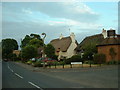
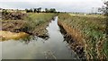
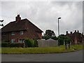
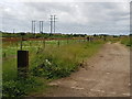
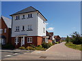
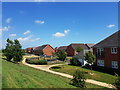
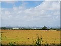
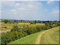
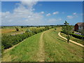
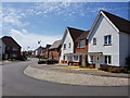
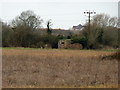
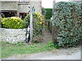
Bersted is a civil parish located in the Arun district of West Sussex, covering an area of 7.1 km². This district comprises the villages of North Bersted and the area known as Shripney, though South Bersted remains a separate adjacent parish. The location sits immediately north of Bognor Regis near the south coast, forming part of the town's built-up area. You can access the locality via the A259 road, which runs approximately 1.6 km northwest of the Bognor Regis town centre. Originally mentioned in the Domesday Book of 1086 as part of Pagham, the area later split into distinct parishes. During the Second World War, the locality hosted significant military infrastructure, including a decoy facility designed to divert bombers from Portsmouth and a temporary aerodrome for RAF squadrons supporting D-Day. Today, Bersted functions as a suburban parish that merges into the wider conurbation. It offers a setting that balances proximity to the town with quieter village surroundings. The nightlife and commercial heart lie just south, but North Bersted itself remains a peaceful village surrounded by countryside. This makes it an ideal location for those seeking to escape urban hustle while staying close to practical amenities. The mix of historical flint and brick thatched cottages from around 1700 contrasts with modern industrial developments found to the east.
- Area Type
- Parish
- Area Size
- 7.1 km²
- Population
- Not available
- Population Density
- Not available
Demographics
The demographic profile of Bersted indicates an older population compared to many other regions. The median age of residents stands at 70 years. This high figure suggests that a significant portion of the community consists of retirees or older adults. Standard data regarding the full breakdown of age ranges, household composition, and predominant ethnic groups is not provided for this specific parish. Consequently, you cannot determine the exact percentage of young families or the level of ethnic diversity within the immediate boundaries. Religious preferences are also not detailed in the available records. Despite the age skew shown by the 70-year median, 77% of the population in Bersted owns their homes outright. This high ownership rate contrasts with areas where rental properties dominate the stock. The lack of specific household composition data means you cannot definitively state the number of singles, couples without children, or multi-generational families living here. However, the substantial home ownership figure points toward a stable, long-term community. For buyers, the presence of so many homeowners indicates that property here is often viewed as a lifetime asset rather than a short-term investment.
Household Size
Accommodation Type
Tenure
Ethnic Group
Religion
Household Composition
Age
Household Deprivation
NS-SEC
Explore more demographic insights in this area
Go to Demographics tabPlanning
Planning Constraints
- Flood RiskPremium
- Ramsar Wetland SitesPremium
- Area of Outstanding Natural BeautyPremium
- Protected Nature ReservePremium
- Protected WoodlandPremium