Area Overview for Lancing
Photos of Lancing
Area Information
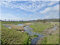
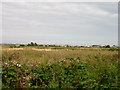
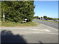
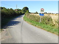
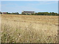
Lancing is a large coastal village and civil parish located in the Adur district of West Sussex. The parish covers 9.4 square kilometres and forms the western edge of the Adur Valley. Its eastern boundary is defined by the River Adur, while ancient field boundaries persist to the north on the South Downs. This area is not a shrinking village but a substantial community with a population of 7,552 residents. The name derives from Saxon origins, likely referring to the people of Wlanc, with settlement remains dating back to the 6th century. Daily life in Lancing reflects a shift from its agricultural past to a modern suburban existence. Historical salt-making and market gardening have given way to housing that forms part of the wider Brighton and Worthing conurbation. You will notice the towering Gothic silhouette of Lancing College Chapel dominating the skyline, a structure that remains technically unfinished even today. The village retains historical depth with St James the Less Church, featuring a distinctive pyramid slate roof added in 1621. Families here live within a parish that spans 2,236 acres, blending residential streets with green common land. Living in Lancing means enjoying a home that sits on land with nearly a millennium of continuous human history while benefiting from modern infrastructure connections.
- Area Type
- Parish
- Area Size
- 9.4 km²
- Population
- 7552
- Population Density
- 807 people/km²
Demographics
The community in Lancing displays a distinct age profile compared to many urban centres. The median age for residents is 70, indicating a population skewed significantly towards older adults. Historical data shows the most common age range simply categorised as 'Age: Total', reflecting the broad spread within this mature demographic. A large proportion of the population are retirees or those approaching retirement, creating a quiet, established neighbourhood atmosphere. Home ownership is the primary form of housing tenure, with 75% of households owning their homes outright or with a mortgage. This high level of equity suggests a stable community with long-term residents rather than a transient rental market. The area does not appear to have significant pockets of deprivation based on the available indicators. While specific data on household composition and predominant ethnic groups is not detailed in the current records, the high ownership rate implies strong local ties. You will find that living in Lancing involves engaging with a society where financial stability and length of residence are common characteristics of the neighbours you meet on the high street or in local shops.
Household Size
Accommodation Type
Tenure
Ethnic Group
Religion
Household Composition
Age
Household Deprivation
NS-SEC
Explore more demographic insights in this area
Go to Demographics tabPlanning
Planning Constraints
- Flood RiskPremium
- Ramsar Wetland SitesPremium
- Area of Outstanding Natural BeautyPremium
- Protected Nature ReservePremium
- Protected WoodlandPremium