Area Overview for Lancing and Sompting
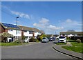
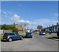
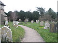
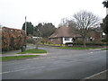
Photos of Lancing and Sompting
Area Information
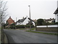
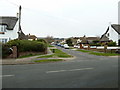
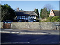
Living in Lancing and Sompting offers a defined residential experience within a built-up area spanning 7.6 square kilometres. This settlement functions as a distinct town with a population of 7,520 residents, creating a community that feels intimate yet fully established. The density stands at 988 people per square kilometre, indicating a resident base that is relatively compact compared to the wider South Downs region. You will find a locality where daily life revolves around a clear centre, allowing for easy access to local services without the congestion of larger metropolitan hubs. The area maintains a traditional character consistent with its status as a bonded neighbourhood on the coast. It is a place where streets are familiar and neighbours tend to know one another, supported by a specific population size that foster personal connections. Prospective buyers looking for a settled environment will appreciate the clear boundaries and defined nature of this 7.6 km² zone. The community structure is self-contained, offering a straightforward lifestyle where residents can manage daily needs efficiently within the town limits.
- Area Type
- Built Up Area 250
- Area Size
- 7.6 km²
- Population
- 7520
- Population Density
- 988 people/km²
Your lifestyle in Lancing and Sompting benefits from a cluster of accessible amenities located just outside the immediate residential zone. Retail options are concentrated in key locations, featuring Co-op Lancing, Asda Lancing, and The Southern Co-operative Co. These specific venues offer everything from groceries to day-to-day essentials without a long daily commute. For those needing to travel, rail connections are available through Lancing Railway Station, East Worthing Railway Station, and access points near Shoreham. This rail network provides direct links to Brighton and beyond, integrating the town into the wider transport system. Aviation access is also unique to this area, with Shoreham Airport and Shoreham Brighton City Airport located within practical reach. These airports provide regional flights that are not available in many other coastal towns. You will find a convenient mix of supermarkets, public transport, and air travel options that supports a varied daily routine. The presence of these five major retail outlets and multiple transport hubs means you can manage shopping or travel needs efficiently from your doorstep in Lancing and Sompting.
Amenities
Schools
Families residing in Lancing and Sompting have access to a clear mix of educational institutions within practical reach. The nearest nurseries include Boundstone Nursery School, providing early years education for young children. Primary education options are well represented by several schools, including Freshbrook First School in Lancing, Oakfield Middle School, and Templars First School in Sompting. These institutions form the lower tier of the local education system, offering schooling for children before they enter secondary education. North Lancing Primary School stands out in the local list with an Ofsted rating of good, providing a verified standard of education for primary pupils. This specific rating confirms a high standard of provision in that particular setting. While the data does not list secondary schools, the presence of these named primary institutions indicates a layered approach to local education. You can identify specific schools such as North Lancing Primary School and Freshbrook First School when planning your child's education. This selection gives you multiple choices for primary schooling directly adjacent to your potential new home.
| Rank | School | Type | Entry gender | Ages |
|---|
Explore more schools in this area
Go to Schools tabDemographics
The community in Lancing and Sompting has a notably mature age profile, with a median age of 70 years. This demographic shift suggests the area is home to many retirees and long-term residents rather than young families in their initial stages of adulthood. House ownership remains a cornerstone of this population, with 73% of residents owning their homes. This high rate indicates a stable, settled population that has invested in the locality over many years. The settlement is not a transient rental zone but a place where people put down roots. While the provided information does not specify the breakdown of household compositions or predominant ethnic groups, the high ownership figure points toward stability. The age structure implies a slower pace of life where community activities likely cater to older demographics. You can expect a neighbourhood where residents have lived for decades, resulting in established routines and deep local knowledge. The lack of a young median age means you will not find the chaos of a student town, instead finding a quiet, senior-led community atmosphere.