Area Overview for TN39 3RR
Photos of TN39 3RR


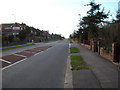

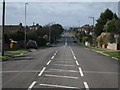
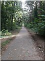
28 photos from this area
Area Information
Key information about the TN39 3RR including its size, population, and administrative classification.
- Area Type
- Postcode
- Area Size
- 1.7 hectares
- Population
- 1531
- Population Density
- 2842 people/km²
House Prices in TN39 3RR
21
Properties
£426,258
Average Sold Price
£124,000
Lowest Price
£699,950
Highest Price
Showing 21 properties
| Address | Type | Beds | Baths | Last Sale Price | Last Sale Date | |
|---|---|---|---|---|---|---|
| Bursdon, 5 Alexander Drive, Bexhill, TN39 3RR | Bungalow | 3 | 1 | £627,500 | Sep 2024 | |
| Karaselle, 10 Alexander Drive, Bexhill, TN39 3RR | Bungalow | 4 | 2 | £699,950 | Aug 2024 | |
| Rowan, 4 Alexander Drive, Bexhill, TN39 3RR | Detached | 2 | 1 | £465,000 | Oct 2023 | |
| 14 Alexander Drive, Bexhill, TN39 3RR | Bungalow | 3 | 1 | £620,000 | Jul 2023 | |
| 23 Alexander Drive, Bexhill, TN39 3RR | Chalet | 4 | 3 | £670,000 | Mar 2023 | |
| Tranquility, 3 Alexander Drive, Bexhill, TN39 3RR | Bungalow | 2 | - | £465,000 | Jun 2021 | |
| 18 Alexander Drive, Bexhill, TN39 3RR | Bungalow | 3 | - | £490,000 | Dec 2018 | |
| Wynchmore, 17 Alexander Drive, Bexhill, TN39 3RR | Bungalow | 3 | - | £482,000 | Oct 2018 | |
| Wintersun, 2 Alexander Drive, Bexhill, TN39 3RR | Bungalow | 3 | - | £300,000 | Oct 2017 | |
| Willow Dene, 19 Alexander Drive, Bexhill, TN39 3RR | Bungalow | 3 | - | £427,000 | Dec 2016 |
Page 1 of 3
Energy Efficiency in TN39 3RR
Amenities
Schools
| Rank | School | Type | Entry gender | Ages |
|---|
Explore more schools in this area
Go to Schools tabDemographics
Household Size
Two person
most common
Accommodation Type
Houses
most common
Tenure
91
majority
Ethnic Group
White
most common
Religion
N/A
most common
Household Composition
N/A
most common
Age
47
median
Elderly (65+ years)
most common
Household Deprivation
N/A
with no deprivation
NS-SEC
40
in Lower managerial occupations
Explore more demographic insights in this area
Go to Demographics tabPlanning
Planning Constraints
- Flood RiskPremium
- Ramsar Wetland SitesPremium
- Area of Outstanding Natural BeautyPremium
- Protected Nature ReservePremium
- Protected WoodlandPremium