Area Overview for TN39 3RT
Photos of TN39 3RT
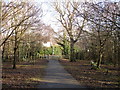
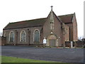
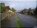
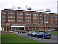

28 photos from this area
Area Information
Key information about the TN39 3RT including its size, population, and administrative classification.
- Area Type
- Postcode
- Area Size
- 2.5 hectares
- Population
- 1531
- Population Density
- 2842 people/km²
House Prices in TN39 3RT
43
Properties
£297,500
Average Sold Price
£280,000
Lowest Price
£315,000
Highest Price
Showing 43 properties
| Address | Type | Beds | Baths | Last Sale Price | Last Sale Date | |
|---|---|---|---|---|---|---|
| 15 Collington Rise, Bexhill, TN39 3RT | Detached | - | - | £315,000 | Sep 2003 | |
| 17 Collington Rise, Bexhill, TN39 3RT | Bungalow | 3 | - | £280,000 | Jun 2002 | |
| Treetops, 16 Collington Rise, Bexhill, TN39 3RT | Detached | 4 | 5 | - | - | |
| Birch Croft, 12 Collington Rise, Bexhill, TN39 3RT | Detached | 5 | 2 | - | - | |
| 8 Collington Rise, Bexhill, TN39 3RT | Detached | 4 | 2 | - | - | |
| Blithe Cottage, 18 Collington Rise, Bexhill, TN39 3RT | Detached | 5 | 2 | - | - | |
| Outspan, 19 Collington Rise, Bexhill, TN39 3RT | Detached | 4 | - | - | - | |
| Manora, 2 Collington Rise, Bexhill, TN39 3RT | Detached | 4 | - | - | - | |
| Woodham, 7 Collington Rise, Bexhill, TN39 3RT | Detached | 4 | - | - | - | |
| Flat 9, Collington House, 3 Collington Rise, Bexhill, TN39 3RT | Flat | - | - | - | - |
Page 1 of 5
Energy Efficiency in TN39 3RT
Amenities
Schools
| Rank | School | Type | Entry gender | Ages |
|---|
Explore more schools in this area
Go to Schools tabDemographics
Household Size
Two person
most common
Accommodation Type
Houses
most common
Tenure
91
majority
Ethnic Group
White
most common
Religion
N/A
most common
Household Composition
N/A
most common
Age
47
median
Elderly (65+ years)
most common
Household Deprivation
N/A
with no deprivation
NS-SEC
40
in Lower managerial occupations
Explore more demographic insights in this area
Go to Demographics tabPlanning
Planning Constraints
- Flood RiskPremium
- Ramsar Wetland SitesPremium
- Area of Outstanding Natural BeautyPremium
- Protected Nature ReservePremium
- Protected WoodlandPremium