Area Overview for TN39 3RW
Photos of TN39 3RW

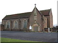
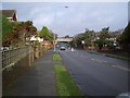


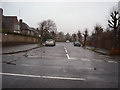
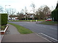

28 photos from this area
Area Information
Key information about the TN39 3RW including its size, population, and administrative classification.
- Area Type
- Postcode
- Area Size
- 4547 m²
- Population
- 1712
- Population Density
- 2159 people/km²
House Prices in TN39 3RW
18
Properties
£197,430
Average Sold Price
£93,000
Lowest Price
£260,000
Highest Price
Showing 18 properties
| Address | Type | Beds | Baths | Last Sale Price | Last Sale Date | |
|---|---|---|---|---|---|---|
| 15, The Borodales, White Hill Drive, Bexhill, TN39 3RW | Flat | 2 | 1 | £247,000 | Sep 2024 | |
| 17, The Borodales, White Hill Drive, Bexhill, TN39 3RW | Flat | - | - | £260,000 | Aug 2022 | |
| 11, The Borodales, White Hill Drive, Bexhill, TN39 3RW | Flat | 2 | 1 | £245,000 | Feb 2022 | |
| 5, The Borodales, White Hill Drive, Bexhill, TN39 3RW | Flat | - | - | £235,500 | Aug 2021 | |
| 12, The Borodales, White Hill Drive, Bexhill, TN39 3RW | Flat | 2 | 1 | £232,000 | Jul 2021 | |
| 8, The Borodales, White Hill Drive, Bexhill, TN39 3RW | Flat | 2 | 2 | £235,000 | Mar 2021 | |
| 7, The Borodales, White Hill Drive, Bexhill, TN39 3RW | Flat | 2 | - | £229,950 | Nov 2019 | |
| 10, The Borodales, White Hill Drive, Bexhill, TN39 3RW | Flat | - | - | £176,000 | Feb 2017 | |
| 13, The Borodales, White Hill Drive, Bexhill, TN39 3RW | Flat | - | - | £163,000 | Jun 2013 | |
| 1, The Borodales, White Hill Drive, Bexhill, TN39 3RW | Flat | - | - | £162,000 | Jun 2012 |
Page 1 of 2
Energy Efficiency in TN39 3RW
Amenities
Schools
| Rank | School | Type | Entry gender | Ages |
|---|
Explore more schools in this area
Go to Schools tabDemographics
Household Size
Two person
most common
Accommodation Type
Houses
most common
Tenure
81
majority
Ethnic Group
White
most common
Religion
N/A
most common
Household Composition
N/A
most common
Age
70
median
Elderly (65+ years)
most common
Household Deprivation
N/A
with no deprivation
NS-SEC
38
in Lower managerial occupations
Explore more demographic insights in this area
Go to Demographics tabPlanning
Planning Constraints
- Flood RiskPremium
- Ramsar Wetland SitesPremium
- Area of Outstanding Natural BeautyPremium
- Protected Nature ReservePremium
- Protected WoodlandPremium