Area Overview for TN27 9HX
Photos of TN27 9HX

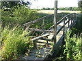
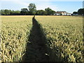


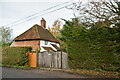

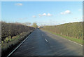

51 photos from this area
Area Information
Key information about the TN27 9HX including its size, population, and administrative classification.
- Area Type
- Postcode
- Area Size
- 1.4 km²
- Population
- 1733
- Population Density
- 86 people/km²
House Prices in TN27 9HX
23
Properties
£885,000
Average Sold Price
£885,000
Lowest Price
£885,000
Highest Price
Showing 23 properties
| Address | Type | Beds | Baths | Last Sale Price | Last Sale Date | |
|---|---|---|---|---|---|---|
| Shenley House, Shenley Road, Headcorn, TN27 9HX | Detached | - | - | £885,000 | Oct 2020 | |
| Land North West Of White House Farm Forming Part Of Shenley Farm (headcorn Aerodrome), Shenley Road, Headcorn, TN27 9HX | commercial | - | - | - | - | |
| The Mobile, Headcorn Aerodrome, Shenley Road, Headcorn, TN27 9HX | Office | - | - | - | - | |
| White House Cottage, Shenley Road, Headcorn, TN27 9HX | Detached | - | - | - | - | |
| Green Lane Veterinary Clinic, Shenley Farm, Shenley Road, Headcorn, TN27 9HX | primary_healthcare | - | - | - | - | |
| Wings, Shenley Road, Headcorn, TN27 9HX | Detached | - | - | - | - | |
| The Holding Point Cafe, Headcorn Aerodrome, Shenley Road, Headcorn, TN27 9HX | Restaurant | - | - | - | - | |
| Skydive Headcorn, Headcorn Aerodrome, Shenley Road, Headcorn, TN27 9HX | office_workshop | - | - | - | - | |
| Shenley Airfield, Shenley Road, Smarden, TN27 9HX | commercial | - | - | - | - | |
| Headcorn Aerodrome, Shenley Farm, Shenley Road, Headcorn, TN27 9HX | commercial | - | - | - | - |
Page 1 of 3
Energy Efficiency in TN27 9HX
Amenities
Schools
| Rank | School | Type | Entry gender | Ages |
|---|
Explore more schools in this area
Go to Schools tabDemographics
Household Size
Two person
most common
Accommodation Type
Houses
most common
Tenure
71
majority
Ethnic Group
White
most common
Religion
N/A
most common
Household Composition
N/A
most common
Age
47
median
Adults (30-64 years)
most common
Household Deprivation
N/A
with no deprivation
NS-SEC
37
in Lower managerial occupations
Explore more demographic insights in this area
Go to Demographics tabPlanning
Planning Constraints
- Flood RiskPremium
- Ramsar Wetland SitesPremium
- Area of Outstanding Natural BeautyPremium
- Protected Nature ReservePremium
- Protected WoodlandPremium