Area Overview for TN27 8PN
Photos of TN27 8PN
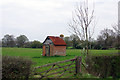
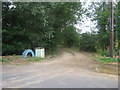
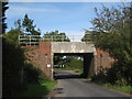
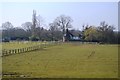
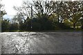
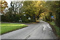
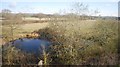
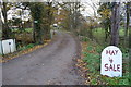
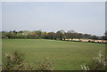
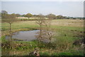
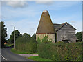
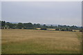
31 photos from this area
Area Information
Key information about the TN27 8PN including its size, population, and administrative classification.
- Area Type
- Postcode
- Area Size
- 61.6 hectares
- Population
- 1455
- Population Density
- 67 people/km²
House Prices in TN27 8PN
17
Properties
£636,667
Average Sold Price
£440,000
Lowest Price
£900,000
Highest Price
Showing 17 properties
| Address | Type | Beds | Baths | Last Sale Price | Last Sale Date | |
|---|---|---|---|---|---|---|
| Munks Farm, Headcorn Road, Smarden, TN27 8PN | Detached | 7 | - | £900,000 | Jul 2021 | |
| Buckleberry Vane, Headcorn Road, Smarden, TN27 8PN | Detached | 4 | 2 | £570,000 | Dec 2013 | |
| Lissenden Farm, Headcorn Road, Smarden, TN27 8PN | Detached | - | - | £440,000 | Oct 1998 | |
| The Barn, Duckies Farm, Headcorn Road, Smarden, TN27 8PN | Semi-detached | 4 | 2 | - | - | |
| Vane Farm, Headcorn Road, Smarden, TN27 8PN | Detached | 4 | 4 | - | - | |
| Bell Farm Oast, Headcorn Road, Smarden, TN27 8PN | Semi-detached | 1 | 1 | - | - | |
| Bell Farm, Headcorn Road, Smarden, TN27 8PN | Detached | 3 | 1 | - | - | |
| The Cabin, Ritoweg Farm, Headcorn Road, Smarden, TN27 8PN | Detached | 7 | 3 | - | - | |
| Mill Barn, Headcorn Road, Smarden, TN27 8PN | Detached | - | - | - | - | |
| Mobile Home Adjacent Vane Farm, Headcorn Road, Smarden, TN27 8PN | undefined | - | - | - | - |
Page 1 of 2
Energy Efficiency in TN27 8PN
Amenities
Schools
| Rank | School | Type | Entry gender | Ages |
|---|
Explore more schools in this area
Go to Schools tabDemographics
Household Size
Two person
most common
Accommodation Type
Houses
most common
Tenure
77
majority
Ethnic Group
White
most common
Religion
N/A
most common
Household Composition
N/A
most common
Age
47
median
Adults (30-64 years)
most common
Household Deprivation
N/A
with no deprivation
NS-SEC
41
in Lower managerial occupations
Explore more demographic insights in this area
Go to Demographics tabPlanning
Planning Constraints
- Flood RiskPremium
- Ramsar Wetland SitesPremium
- Area of Outstanding Natural BeautyPremium
- Protected Nature ReservePremium
- Protected WoodlandPremium