Area Overview for SO43 7AU
Photos of SO43 7AU
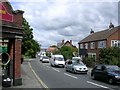


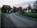
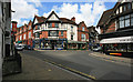
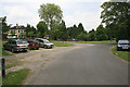
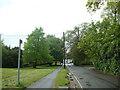

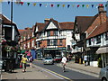
100 photos from this area
Area Information
Key information about the SO43 7AU including its size, population, and administrative classification.
- Area Type
- Postcode
- Area Size
- 4987 m²
- Population
- 1559
- Population Density
- 218 people/km²
House Prices in SO43 7AU
11
Properties
£348,286
Average Sold Price
£105,000
Lowest Price
£530,000
Highest Price
Showing 11 properties
| Address | Type | Beds | Baths | Last Sale Price | Last Sale Date | |
|---|---|---|---|---|---|---|
| The Briars, Broughton Road, Lyndhurst, SO43 7AU | Detached | 3 | 1 | £530,000 | Mar 2025 | |
| Hedgehog Lodge, Broughton Road, Lyndhurst, SO43 7AU | Detached | 3 | 1 | £505,000 | Feb 2021 | |
| Pipit Cottage, Broughton Road, Lyndhurst, SO43 7AU | Semi-detached | 3 | 1 | £345,000 | Jul 2014 | |
| The Hollow, Broughton Road, Lyndhurst, SO43 7AU | house | - | - | £365,000 | Feb 2011 | |
| 1, Malwood Cottages, Broughton Road, Lyndhurst, SO43 7AU | Semi-detached | - | - | £310,000 | Sep 2008 | |
| Montrose, Broughton Road, Lyndhurst, SO43 7AU | Semi-detached | - | - | £278,000 | Jun 2007 | |
| Ockham, Broughton Road, Lyndhurst, SO43 7AU | Detached | 3 | 2 | £105,000 | Dec 1998 | |
| 2, Malwood Cottages, Broughton Road, Lyndhurst, SO43 7AU | Semi-detached | - | - | - | - | |
| Pantiles, Broughton Road, Lyndhurst, SO43 7AU | Detached | - | - | - | - | |
| Bluebell Cottage, Broughton Road, Lyndhurst, SO43 7AU | Semi-detached | - | - | - | - |
Page 1 of 2
Energy Efficiency in SO43 7AU
Amenities
Schools
| Rank | School | Type | Entry gender | Ages |
|---|
Explore more schools in this area
Go to Schools tabDemographics
Household Size
Two person
most common
Accommodation Type
Houses
most common
Tenure
85
majority
Ethnic Group
White
most common
Religion
N/A
most common
Household Composition
N/A
most common
Age
47
median
Adults (30-64 years)
most common
Household Deprivation
N/A
with no deprivation
NS-SEC
49
in Lower managerial occupations
Explore more demographic insights in this area
Go to Demographics tabPlanning
Planning Constraints
- Flood RiskPremium
- Ramsar Wetland SitesPremium
- Area of Outstanding Natural BeautyPremium
- Protected Nature ReservePremium
- Protected WoodlandPremium