Area Overview for SO43 7AS
Photos of SO43 7AS
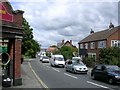
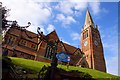
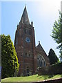
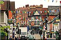
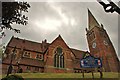
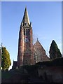
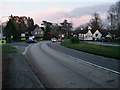
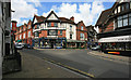
100 photos from this area
Area Information
Key information about the SO43 7AS including its size, population, and administrative classification.
- Area Type
- Postcode
- Area Size
- 1.3 hectares
- Population
- 1460
- Population Density
- 159 people/km²
House Prices in SO43 7AS
8
Properties
£416,250
Average Sold Price
£415,000
Lowest Price
£417,500
Highest Price
Showing 8 properties
| Address | Type | Beds | Baths | Last Sale Price | Last Sale Date | |
|---|---|---|---|---|---|---|
| Oakdene, Pikes Hill, Lyndhurst, SO43 7AS | house | 4 | - | £417,500 | Sep 2011 | |
| 1 Pikes Hill, Lyndhurst, SO43 7AS | Retail | 2 | 1 | £415,000 | Oct 2010 | |
| Cornerstones, 3 Pikes Hill, Lyndhurst, SO43 7AS | Semi-detached | 5 | 2 | - | - | |
| Pinecroft, 2 Pikes Hill, Lyndhurst, SO43 7AS | Semi-detached | 2 | - | - | - | |
| Gas Governor (pikes Hill), Romsey Road, Lyndhurst, SO43 7AS | Industrial | - | - | - | - | |
| Foxgloves, Pikes Hill, Lyndhurst, SO43 7AS | house | - | - | - | - | |
| Waterloo Arms Public House, Waterloo Arms, Pikes Hill, Lyndhurst, SO43 7AS | restaurant_cafe | - | - | - | - | |
| 4 Pikes Hill, Lyndhurst, SO43 7AS | Semi-detached | - | - | - | - |
Energy Efficiency in SO43 7AS
Amenities
Schools
| Rank | School | Type | Entry gender | Ages |
|---|
Explore more schools in this area
Go to Schools tabDemographics
Household Size
Two person
most common
Accommodation Type
Houses
most common
Tenure
60
majority
Ethnic Group
White
most common
Religion
N/A
most common
Household Composition
N/A
most common
Age
47
median
Adults (30-64 years)
most common
Household Deprivation
N/A
with no deprivation
NS-SEC
41
in Lower managerial occupations
Explore more demographic insights in this area
Go to Demographics tabPlanning
Planning Constraints
- Flood RiskPremium
- Ramsar Wetland SitesPremium
- Area of Outstanding Natural BeautyPremium
- Protected Nature ReservePremium
- Protected WoodlandPremium