Area Overview for SO42 7TT
Photos of SO42 7TT
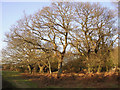
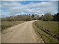
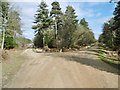
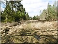
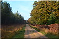
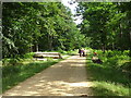
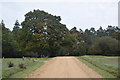
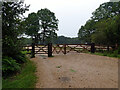
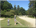
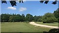
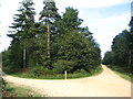
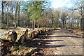
25 photos from this area
Area Information
Key information about the SO42 7TT including its size, population, and administrative classification.
- Area Type
- Postcode
- Area Size
- 1.4 km²
- Population
- 2081
- Population Density
- 16 people/km²
House Prices in SO42 7TT
36
Properties
£608,214
Average Sold Price
£295,000
Lowest Price
£915,000
Highest Price
Showing 36 properties
| Address | Type | Beds | Baths | Last Sale Price | Last Sale Date | |
|---|---|---|---|---|---|---|
| Braeside, Balmer Lawn Road, Brockenhurst, SO42 7TT | house | - | - | £880,000 | Feb 2022 | |
| Forest Holt, Balmer Lawn Road, Brockenhurst, SO42 7TT | house | - | - | £742,500 | Sep 2020 | |
| Hawthorns, Balmer Lawn Road, Brockenhurst, SO42 7TT | Chalet | 4 | 3 | £850,000 | Aug 2020 | |
| Two Oaks, Balmer Lawn Road, Brockenhurst, SO42 7TT | Detached | 4 | - | £915,000 | Aug 2019 | |
| Woodcote, Balmer Lawn Road, Brockenhurst, SO42 7TT | Chalet | 3 | 1 | £750,000 | Aug 2017 | |
| The Warren, Balmer Lawn Road, Brockenhurst, SO42 7TT | Bungalow | - | - | £750,000 | Sep 2016 | |
| Springwood, Balmer Lawn Road, Brockenhurst, SO42 7TT | Bungalow | 2 | - | £545,000 | Nov 2014 | |
| Little Mead, Balmer Lawn Road, Brockenhurst, SO42 7TT | Detached | 2 | - | £575,000 | Jan 2014 | |
| Sunny Patch, Balmer Lawn Road, Brockenhurst, SO42 7TT | house | - | - | £485,000 | Jan 2014 | |
| Heather Cottage, Balmer Lawn Road, Brockenhurst, SO42 7TT | Bungalow | 3 | - | £450,000 | Feb 2013 |
Page 1 of 4
Energy Efficiency in SO42 7TT
Amenities
Schools
| Rank | School | Type | Entry gender | Ages |
|---|
Explore more schools in this area
Go to Schools tabDemographics
Household Size
Two person
most common
Accommodation Type
Houses
most common
Tenure
61
majority
Ethnic Group
White
most common
Religion
N/A
most common
Household Composition
N/A
most common
Age
47
median
Adults (30-64 years)
most common
Household Deprivation
N/A
with no deprivation
NS-SEC
41
in Lower managerial occupations
Explore more demographic insights in this area
Go to Demographics tabPlanning
Planning Constraints
- Flood RiskPremium
- Ramsar Wetland SitesPremium
- Area of Outstanding Natural BeautyPremium
- Protected Nature ReservePremium
- Protected WoodlandPremium