Area Overview for SO42 7QL
Photos of SO42 7QL
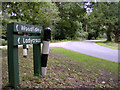
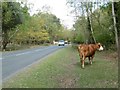
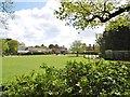
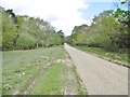
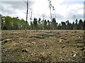

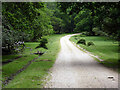

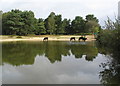
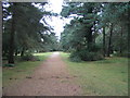
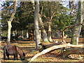
34 photos from this area
Area Information
Key information about the SO42 7QL including its size, population, and administrative classification.
- Area Type
- Postcode
- Area Size
- 6.8 km²
- Population
- 2081
- Population Density
- 16 people/km²
House Prices in SO42 7QL
21
Properties
£2,076,900
Average Sold Price
£370,000
Lowest Price
£7,315,500
Highest Price
Showing 21 properties
| Address | Type | Beds | Baths | Last Sale Price | Last Sale Date | |
|---|---|---|---|---|---|---|
| Peace Cottage, Beaulieu Road, Brockenhurst, SO42 7QL | Detached | 3 | 2 | £1,504,000 | Oct 2023 | |
| Ladycross Lodge, Beaulieu Road, Brockenhurst, SO42 7QL | Detached | 10 | 7 | £7,315,500 | Jan 2017 | |
| 2, Woodfidley Cottage, Beaulieu Road, Brockenhurst, SO42 7QL | Cottage | 3 | 1 | £370,000 | Mar 2015 | |
| 1, Woodfidley Cottage, Beaulieu Road, Brockenhurst, SO42 7QL | house | - | - | £400,000 | Dec 2012 | |
| Owners Annexe, The Pig, Beaulieu Road, Brockenhurst, SO42 7QL | Flat | - | - | £795,000 | Jul 2004 | |
| Hamilton Cottage, Beaulieu Road, Brockenhurst, SO42 7QL | Semi-detached | - | - | - | - | |
| The Old Stableyard, Beaulieu Road, Brockenhurst, SO42 7QL | Detached | - | - | - | - | |
| Mulberry Cottage, Beaulieu Road, Brockenhurst, SO42 7QL | Detached | - | - | - | - | |
| Coachmans Cottage, Beaulieu Road, Brockenhurst, SO42 7QL | Detached | - | - | - | - | |
| Mulberry Cottage, Beaulieu Road, Brockenhurst, SO42 7QL | Detached | - | - | - | - |
Page 1 of 3
Energy Efficiency in SO42 7QL
Amenities
Schools
| Rank | School | Type | Entry gender | Ages |
|---|
Explore more schools in this area
Go to Schools tabDemographics
Household Size
Two person
most common
Accommodation Type
Houses
most common
Tenure
61
majority
Ethnic Group
White
most common
Religion
N/A
most common
Household Composition
N/A
most common
Age
47
median
Adults (30-64 years)
most common
Household Deprivation
N/A
with no deprivation
NS-SEC
41
in Lower managerial occupations
Explore more demographic insights in this area
Go to Demographics tabPlanning
Planning Constraints
- Flood RiskPremium
- Ramsar Wetland SitesPremium
- Area of Outstanding Natural BeautyPremium
- Protected Nature ReservePremium
- Protected WoodlandPremium