Area Overview for SO42 7WT
Photos of SO42 7WT
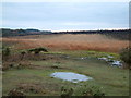

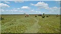
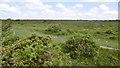

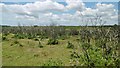
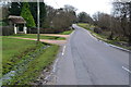
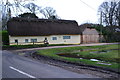


20 photos from this area
Area Information
Key information about the SO42 7WT including its size, population, and administrative classification.
- Area Type
- Postcode
- Area Size
- 5.5 km²
- Population
- 2081
- Population Density
- 16 people/km²
House Prices in SO42 7WT
59
Properties
£669,091
Average Sold Price
£150,000
Lowest Price
£1,600,000
Highest Price
Showing 59 properties
| Address | Type | Beds | Baths | Last Sale Price | Last Sale Date | |
|---|---|---|---|---|---|---|
| Sherfield Cottage, Main Road, East Boldre, SO42 7WT | Detached | 2 | 1 | £519,500 | Mar 2025 | |
| Box Cottage, Main Road, East Boldre, SO42 7WT | Detached | 3 | 3 | £1,600,000 | Oct 2024 | |
| Snowdrop Cottage, Main Road, East Boldre, SO42 7WT | Detached | 6 | 2 | £850,000 | Oct 2022 | |
| Willow Cottage, Main Road, East Boldre, SO42 7WT | Bungalow | - | - | £1,350,000 | Jun 2021 | |
| Tinsleys Cottage, Main Road, East Boldre, SO42 7WT | Cottage | 3 | 1 | £585,000 | Feb 2021 | |
| Homestead Cottage, Main Road, East Boldre, SO42 7WT | house | - | - | £800,000 | Jan 2021 | |
| Clear Springs, Main Road, East Boldre, SO42 7WT | house | 3 | - | £930,000 | Dec 2018 | |
| Cornerways, Main Road, East Boldre, SO42 7WT | Bungalow | 2 | 2 | £385,000 | Oct 2016 | |
| Norfolk House, Main Road, East Boldre, SO42 7WT | Detached | 4 | - | £965,000 | Jul 2014 | |
| Mallards, Main Road, East Boldre, SO42 7WT | house | - | - | £1,250,000 | Mar 2011 |
Page 1 of 6
Energy Efficiency in SO42 7WT
Amenities
Schools
| Rank | School | Type | Entry gender | Ages |
|---|
Explore more schools in this area
Go to Schools tabDemographics
Household Size
Two person
most common
Accommodation Type
Houses
most common
Tenure
61
majority
Ethnic Group
White
most common
Religion
N/A
most common
Household Composition
N/A
most common
Age
47
median
Adults (30-64 years)
most common
Household Deprivation
N/A
with no deprivation
NS-SEC
41
in Lower managerial occupations
Explore more demographic insights in this area
Go to Demographics tabPlanning
Planning Constraints
- Flood RiskPremium
- Ramsar Wetland SitesPremium
- Area of Outstanding Natural BeautyPremium
- Protected Nature ReservePremium
- Protected WoodlandPremium