Area Overview for SO41 6DN
Photos of SO41 6DN
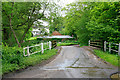

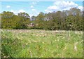
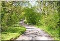
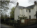
23 photos from this area
Area Information
Key information about the SO41 6DN including its size, population, and administrative classification.
- Area Type
- Postcode
- Area Size
- 50.0 hectares
- Population
- 2114
- Population Density
- 143 people/km²
House Prices in SO41 6DN
28
Properties
£1,093,667
Average Sold Price
£470,000
Lowest Price
£3,045,000
Highest Price
Showing 28 properties
| Address | Type | Beds | Baths | Last Sale Price | Last Sale Date | |
|---|---|---|---|---|---|---|
| Little Place, Flexford Lane, Sway, SO41 6DN | house | 4 | 2 | £712,000 | Aug 2021 | |
| Hazelhurst Lodge, Flexford Lane, Sway, SO41 6DN | Flat | 1 | 1 | £3,045,000 | Sep 2020 | |
| Merrifield, Flexford Lane, Sway, SO41 6DN | Detached | 9 | 8 | £735,000 | Apr 2017 | |
| Lepe House, Flexford Lane, Sway, SO41 6DN | house | - | - | £950,000 | Nov 2016 | |
| Birch Barn, Flexford Lane, Sway, SO41 6DN | house | 4 | - | £650,000 | Jul 2014 | |
| South Lodge, Flexford Lane, Sway, SO41 6DN | Bungalow | 3 | - | £470,000 | Mar 2014 | |
| Hazelhurst Farm, Flexford Lane, Sway, SO41 6DN | Detached | 3 | 2 | - | - | |
| Flexford Rise, Flexford Lane, Sway, SO41 6DN | Land | - | - | - | - | |
| Bridge Farm, Flexford Lane, Sway, SO41 6DN | house | 4 | 2 | - | - | |
| Arnewood Court Cottage, Flexford Lane, Sway, SO41 6DN | Flat | 2 | 2 | - | - |
Page 1 of 3
Energy Efficiency in SO41 6DN
Amenities
Schools
| Rank | School | Type | Entry gender | Ages |
|---|
Explore more schools in this area
Go to Schools tabDemographics
Household Size
Two person
most common
Accommodation Type
Houses
most common
Tenure
87
majority
Ethnic Group
White
most common
Religion
N/A
most common
Household Composition
N/A
most common
Age
47
median
Adults (30-64 years)
most common
Household Deprivation
N/A
with no deprivation
NS-SEC
44
in Lower managerial occupations
Explore more demographic insights in this area
Go to Demographics tabPlanning
Planning Constraints
- Flood RiskPremium
- Ramsar Wetland SitesPremium
- Area of Outstanding Natural BeautyPremium
- Protected Nature ReservePremium
- Protected WoodlandPremium