Area Overview for SO41 6DD
Photos of SO41 6DD
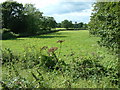
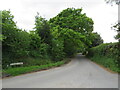
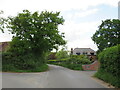
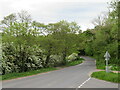

21 photos from this area
Area Information
Key information about the SO41 6DD including its size, population, and administrative classification.
- Area Type
- Postcode
- Area Size
- 24.6 hectares
- Population
- 2114
- Population Density
- 143 people/km²
House Prices in SO41 6DD
31
Properties
£563,000
Average Sold Price
£226,000
Lowest Price
£900,000
Highest Price
Showing 31 properties
| Address | Type | Beds | Baths | Last Sale Price | Last Sale Date | |
|---|---|---|---|---|---|---|
| Downlands Cottage, Barrows Lane, Sway, SO41 6DD | house | - | - | £900,000 | Dec 2021 | |
| Meadowbrook Lodge, Barrows Lane, Sway, SO41 6DD | Detached | - | - | £226,000 | Apr 2002 | |
| Tower Farm, Barrows Lane, Sway, SO41 6DD | Detached | 3 | 2 | - | - | |
| Arnewood Towers House, Barrows Lane, Sway, SO41 6DD | Detached | 3 | 2 | - | - | |
| Avonwater House, Barrows Lane, Sway, SO41 6DD | Detached | 10 | 6 | - | - | |
| Arnewood Court Farm House, Barrows Lane, Sway, SO41 6DD | Detached | 3 | - | - | - | |
| The Coach House, Avonwater House, Barrows Lane, Sway, SO41 6DD | house | - | - | - | - | |
| North Lodge, Barrows Lane, Sway, SO41 6DD | Cottage | 3 | 1 | - | - | |
| Room 3 Left 4, Sway Storage And Workshops, Barrows Lane, Sway, SO41 6DD | warehouse | - | - | - | - | |
| Cooling And Heating Solutions Ltd, Barn Left 2 Unit A, Old Turkey Farm, Barrows Lane, Sway, SO41 6DD | warehouse | - | - | - | - |
Page 1 of 4
Energy Efficiency in SO41 6DD
Amenities
Schools
| Rank | School | Type | Entry gender | Ages |
|---|
Explore more schools in this area
Go to Schools tabDemographics
Household Size
Two person
most common
Accommodation Type
Houses
most common
Tenure
87
majority
Ethnic Group
White
most common
Religion
N/A
most common
Household Composition
N/A
most common
Age
47
median
Adults (30-64 years)
most common
Household Deprivation
N/A
with no deprivation
NS-SEC
44
in Lower managerial occupations
Explore more demographic insights in this area
Go to Demographics tabPlanning
Planning Constraints
- Flood RiskPremium
- Ramsar Wetland SitesPremium
- Area of Outstanding Natural BeautyPremium
- Protected Nature ReservePremium
- Protected WoodlandPremium