Area Overview for SO20 8BB
Photos of SO20 8BB
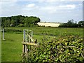
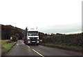
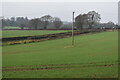
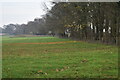
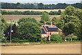
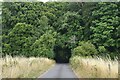
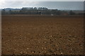
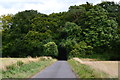
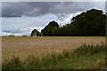
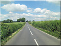
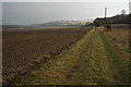
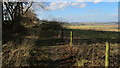
14 photos from this area
Area Information
Key information about the SO20 8BB including its size, population, and administrative classification.
- Area Type
- Postcode
- Area Size
- 22.3 hectares
- Population
- 1583
- Population Density
- 49 people/km²
House Prices in SO20 8BB
10
Properties
£559,460
Average Sold Price
£225,000
Lowest Price
£1,172,300
Highest Price
Showing 10 properties
| Address | Type | Beds | Baths | Last Sale Price | Last Sale Date | |
|---|---|---|---|---|---|---|
| Springfield House, The Hollow, Broughton, SO20 8BB | house | - | - | £1,172,300 | Nov 2023 | |
| Wood Rising, The Hollow, Broughton, SO20 8BB | Detached | 4 | 3 | £410,000 | Oct 2013 | |
| Hawthorns, The Hollow, Broughton, SO20 8BB | Detached | - | - | £465,000 | Oct 2006 | |
| Ford Springs, The Hollow, Broughton, SO20 8BB | house | - | - | £525,000 | Mar 2002 | |
| Vale View, The Hollow, Broughton, SO20 8BB | Bungalow | 2 | - | £225,000 | Jun 2001 | |
| Beenham, 5 The Hollow, Broughton, SO20 8BB | Detached | 2 | - | - | - | |
| St Annes, The Hollow, Broughton, SO20 8BB | Detached | - | - | - | - | |
| St Margarets, The Hollow, Broughton, SO20 8BB | Detached | - | - | - | - | |
| Venison Cottage, The Hollow, Broughton, SO20 8BB | Bungalow | - | - | - | - | |
| Wayside, The Hollow, Broughton, SO20 8BB | Detached | - | - | - | - |
Energy Efficiency in SO20 8BB
Amenities
Schools
| Rank | School | Type | Entry gender | Ages |
|---|
Explore more schools in this area
Go to Schools tabDemographics
Household Size
Two person
most common
Accommodation Type
Houses
most common
Tenure
73
majority
Ethnic Group
White
most common
Religion
N/A
most common
Household Composition
N/A
most common
Age
47
median
Adults (30-64 years)
most common
Household Deprivation
N/A
with no deprivation
NS-SEC
45
in Lower managerial occupations
Explore more demographic insights in this area
Go to Demographics tabPlanning
Planning Constraints
- Flood RiskPremium
- Ramsar Wetland SitesPremium
- Area of Outstanding Natural BeautyPremium
- Protected Nature ReservePremium
- Protected WoodlandPremium