Area Overview for SO19 7JR
Photos of SO19 7JR
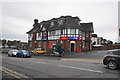

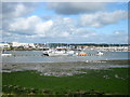


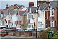

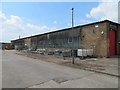
40 photos from this area
Area Information
Key information about the SO19 7JR including its size, population, and administrative classification.
- Area Type
- Postcode
- Area Size
- 6087 m²
- Population
- 1342
- Population Density
- 6164 people/km²
House Prices in SO19 7JR
25
Properties
£156,658
Average Sold Price
£42,660
Lowest Price
£270,000
Highest Price
Showing 25 properties
| Address | Type | Beds | Baths | Last Sale Price | Last Sale Date | |
|---|---|---|---|---|---|---|
| 230 Blackthorn Road, Southampton, SO19 7JR | Semi-detached | 2 | 1 | £260,000 | Jun 2024 | |
| 196 Blackthorn Road, Southampton, SO19 7JR | Semi-detached | 2 | 1 | £270,000 | May 2024 | |
| 206 Blackthorn Road, Southampton, SO19 7JR | house | - | - | £215,000 | Dec 2020 | |
| 242 Blackthorn Road, Southampton, SO19 7JR | Semi-detached | 3 | 1 | £222,000 | Sep 2019 | |
| 222 Blackthorn Road, Southampton, SO19 7JR | Terraced | 3 | 1 | £190,000 | Oct 2017 | |
| 226 Blackthorn Road, Southampton, SO19 7JR | Semi-detached | 2 | 1 | £185,000 | Oct 2016 | |
| 240 Blackthorn Road, Southampton, SO19 7JR | house | - | - | £108,000 | May 2009 | |
| 236 Blackthorn Road, Southampton, SO19 7JR | Terraced | - | - | £144,950 | Feb 2007 | |
| 202 Blackthorn Road, Southampton, SO19 7JR | house | - | - | £133,000 | Sep 2006 | |
| 210 Blackthorn Road, Southampton, SO19 7JR | Terraced | - | - | £141,950 | Sep 2004 |
Page 1 of 3
Energy Efficiency in SO19 7JR
Amenities
Schools
| Rank | School | Type | Entry gender | Ages |
|---|
Explore more schools in this area
Go to Schools tabDemographics
Household Size
Family (3-5 people)
most common
Accommodation Type
Houses
most common
Tenure
55
majority
Ethnic Group
White
most common
Religion
N/A
most common
Household Composition
N/A
most common
Age
47
median
Adults (30-64 years)
most common
Household Deprivation
N/A
with no deprivation
NS-SEC
21
in Lower managerial occupations
Explore more demographic insights in this area
Go to Demographics tabPlanning
Planning Constraints
- Flood RiskPremium
- Ramsar Wetland SitesPremium
- Area of Outstanding Natural BeautyPremium
- Protected Nature ReservePremium
- Protected WoodlandPremium