Area Overview for SO19 7AF
Photos of SO19 7AF

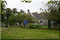
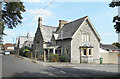
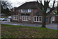
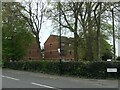

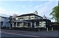

66 photos from this area
Area Information
Key information about the SO19 7AF including its size, population, and administrative classification.
- Area Type
- Postcode
- Area Size
- 1.4 hectares
- Population
- 1596
- Population Density
- 4136 people/km²
House Prices in SO19 7AF
42
Properties
£195,674
Average Sold Price
£54,000
Lowest Price
£290,000
Highest Price
Showing 42 properties
| Address | Type | Beds | Baths | Last Sale Price | Last Sale Date | |
|---|---|---|---|---|---|---|
| 41 Maldon Road, Southampton, SO19 7AF | Bungalow | 2 | 1 | £290,000 | Oct 2025 | |
| 35 Maldon Road, Southampton, SO19 7AF | Bungalow | - | - | £255,000 | Dec 2023 | |
| 61 Maldon Road, Southampton, SO19 7AF | Bungalow | 2 | 1 | £250,000 | Dec 2023 | |
| 49 Maldon Road, Southampton, SO19 7AF | Bungalow | 2 | 1 | £275,000 | Apr 2023 | |
| 63 Maldon Road, Southampton, SO19 7AF | Bungalow | - | - | £252,500 | Apr 2022 | |
| 73 Maldon Road, Southampton, SO19 7AF | Bungalow | - | - | £282,000 | Jul 2021 | |
| 59 Maldon Road, Southampton, SO19 7AF | Bungalow | 2 | 1 | £207,000 | Feb 2021 | |
| 81 Maldon Road, Southampton, SO19 7AF | Bungalow | - | - | £140,000 | Feb 2021 | |
| 65 Maldon Road, Southampton, SO19 7AF | Bungalow | 2 | 1 | £240,000 | Dec 2020 | |
| 39 Maldon Road, Southampton, SO19 7AF | Bungalow | 2 | 1 | £245,000 | May 2020 |
Page 1 of 5
Energy Efficiency in SO19 7AF
Amenities
Schools
| Rank | School | Type | Entry gender | Ages |
|---|
Explore more schools in this area
Go to Schools tabDemographics
Household Size
Two person
most common
Accommodation Type
Houses
most common
Tenure
71
majority
Ethnic Group
White
most common
Religion
N/A
most common
Household Composition
N/A
most common
Age
47
median
Adults (30-64 years)
most common
Household Deprivation
N/A
with no deprivation
NS-SEC
30
in Lower managerial occupations
Explore more demographic insights in this area
Go to Demographics tabPlanning
Planning Constraints
- Flood RiskPremium
- Ramsar Wetland SitesPremium
- Area of Outstanding Natural BeautyPremium
- Protected Nature ReservePremium
- Protected WoodlandPremium