Area Overview for SO19 7AH
Photos of SO19 7AH
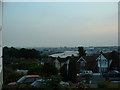
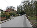
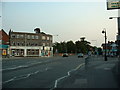
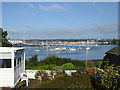
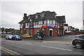
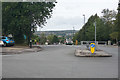
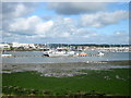

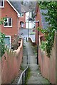
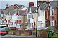

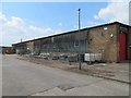
40 photos from this area
Area Information
Key information about the SO19 7AH including its size, population, and administrative classification.
- Area Type
- Postcode
- Area Size
- 5308 m²
- Population
- 1596
- Population Density
- 4136 people/km²
House Prices in SO19 7AH
14
Properties
£171,563
Average Sold Price
£55,000
Lowest Price
£305,000
Highest Price
Showing 14 properties
| Address | Type | Beds | Baths | Last Sale Price | Last Sale Date | |
|---|---|---|---|---|---|---|
| 55 Merridale Road, Southampton, SO19 7AH | Bungalow | 3 | 2 | £305,000 | Apr 2024 | |
| 57 Merridale Road, Southampton, SO19 7AH | Bungalow | 5 | 2 | £200,000 | Jun 2022 | |
| 67 Merridale Road, Southampton, SO19 7AH | Bungalow | - | - | £245,000 | Sep 2021 | |
| 69 Merridale Road, Southampton, SO19 7AH | Bungalow | 3 | 1 | £185,000 | Dec 2015 | |
| 75 Merridale Road, Southampton, SO19 7AH | Bungalow | - | - | £165,000 | Sep 2015 | |
| 73 Merridale Road, Southampton, SO19 7AH | Detached | - | - | £92,500 | Feb 2008 | |
| 77 Merridale Road, Southampton, SO19 7AH | Bungalow | 2 | - | £125,000 | Nov 2006 | |
| 59 Merridale Road, Southampton, SO19 7AH | Bungalow | 2 | 1 | £55,000 | Jan 1996 | |
| 53 Merridale Road, Southampton, SO19 7AH | Detached | 3 | 1 | - | - | |
| 71 Merridale Road, Southampton, SO19 7AH | Detached | - | - | - | - |
Page 1 of 2
Energy Efficiency in SO19 7AH
Amenities
Schools
| Rank | School | Type | Entry gender | Ages |
|---|
Explore more schools in this area
Go to Schools tabDemographics
Household Size
Two person
most common
Accommodation Type
Houses
most common
Tenure
71
majority
Ethnic Group
White
most common
Religion
N/A
most common
Household Composition
N/A
most common
Age
47
median
Adults (30-64 years)
most common
Household Deprivation
N/A
with no deprivation
NS-SEC
30
in Lower managerial occupations
Explore more demographic insights in this area
Go to Demographics tabPlanning
Planning Constraints
- Flood RiskPremium
- Ramsar Wetland SitesPremium
- Area of Outstanding Natural BeautyPremium
- Protected Nature ReservePremium
- Protected WoodlandPremium