Area Overview for SO19 7AW
Photos of SO19 7AW
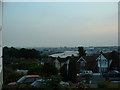
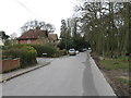
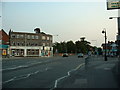
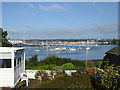
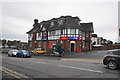
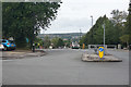
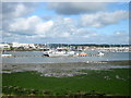

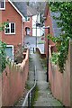
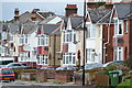
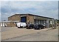
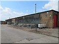
40 photos from this area
Area Information
Key information about the SO19 7AW including its size, population, and administrative classification.
- Area Type
- Postcode
- Area Size
- 1.3 hectares
- Population
- 1596
- Population Density
- 4136 people/km²
House Prices in SO19 7AW
29
Properties
£191,752
Average Sold Price
£64,450
Lowest Price
£353,000
Highest Price
Showing 29 properties
| Address | Type | Beds | Baths | Last Sale Price | Last Sale Date | |
|---|---|---|---|---|---|---|
| 91 Gainsford Road, Southampton, SO19 7AW | Bungalow | 2 | 1 | £260,000 | Jan 2025 | |
| 65 Gainsford Road, Southampton, SO19 7AW | Bungalow | - | - | £220,000 | Apr 2022 | |
| 87 Gainsford Road, Southampton, SO19 7AW | Bungalow | 2 | 1 | £214,000 | Mar 2021 | |
| 73 Gainsford Road, Southampton, SO19 7AW | Semi-detached | 3 | 1 | £280,000 | Nov 2019 | |
| 67 Gainsford Road, Southampton, SO19 7AW | Semi-detached | 4 | 3 | £353,000 | Jan 2018 | |
| 71 Gainsford Road, Southampton, SO19 7AW | house | - | - | £245,000 | Mar 2017 | |
| 57 Gainsford Road, Southampton, SO19 7AW | Bungalow | 2 | 1 | £267,500 | Mar 2017 | |
| 55 Gainsford Road, Southampton, SO19 7AW | Bungalow | 2 | 1 | £220,000 | Jul 2016 | |
| 99 Gainsford Road, Southampton, SO19 7AW | Bungalow | - | - | £184,950 | Feb 2016 | |
| 95 Gainsford Road, Southampton, SO19 7AW | Semi-detached | 3 | 1 | £200,000 | Sep 2014 |
Page 1 of 3
Energy Efficiency in SO19 7AW
Amenities
Schools
| Rank | School | Type | Entry gender | Ages |
|---|
Explore more schools in this area
Go to Schools tabDemographics
Household Size
Two person
most common
Accommodation Type
Houses
most common
Tenure
71
majority
Ethnic Group
White
most common
Religion
N/A
most common
Household Composition
N/A
most common
Age
47
median
Adults (30-64 years)
most common
Household Deprivation
N/A
with no deprivation
NS-SEC
30
in Lower managerial occupations
Explore more demographic insights in this area
Go to Demographics tabPlanning
Planning Constraints
- Flood RiskPremium
- Ramsar Wetland SitesPremium
- Area of Outstanding Natural BeautyPremium
- Protected Nature ReservePremium
- Protected WoodlandPremium