Area Overview for SO19 7AL
Photos of SO19 7AL
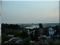
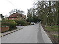
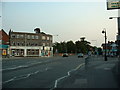
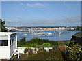
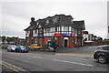
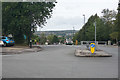
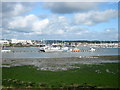

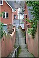
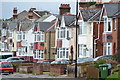
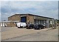
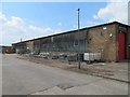
40 photos from this area
Area Information
Key information about the SO19 7AL including its size, population, and administrative classification.
- Area Type
- Postcode
- Area Size
- 6385 m²
- Population
- 1596
- Population Density
- 4136 people/km²
House Prices in SO19 7AL
22
Properties
£179,317
Average Sold Price
£48,500
Lowest Price
£320,000
Highest Price
Showing 22 properties
| Address | Type | Beds | Baths | Last Sale Price | Last Sale Date | |
|---|---|---|---|---|---|---|
| 78 Bryanston Road, Southampton, SO19 7AL | Terraced | 3 | 1 | £272,500 | Jan 2025 | |
| 86 Bryanston Road, Southampton, SO19 7AL | Terraced | 3 | 1 | £320,000 | May 2022 | |
| 89 Bryanston Road, Southampton, SO19 7AL | Terraced | 3 | 1 | £237,000 | Aug 2021 | |
| 87 Bryanston Road, Southampton, SO19 7AL | Semi-detached | 3 | 1 | £261,000 | Apr 2018 | |
| 92 Bryanston Road, Southampton, SO19 7AL | house | - | - | £225,000 | Jul 2017 | |
| 95 Bryanston Road, Southampton, SO19 7AL | Terraced | 4 | - | £270,000 | Aug 2016 | |
| 84 Bryanston Road, Southampton, SO19 7AL | Semi-detached | 3 | - | £195,000 | Jan 2015 | |
| 90 Bryanston Road, Southampton, SO19 7AL | Terraced | 3 | 1 | £188,000 | Oct 2013 | |
| 76 Bryanston Road, Southampton, SO19 7AL | house | - | - | £174,000 | Feb 2010 | |
| 77 Bryanston Road, Southampton, SO19 7AL | Terraced | - | - | £144,000 | Jun 2003 |
Page 1 of 3
Energy Efficiency in SO19 7AL
Amenities
Schools
| Rank | School | Type | Entry gender | Ages |
|---|
Explore more schools in this area
Go to Schools tabDemographics
Household Size
Two person
most common
Accommodation Type
Houses
most common
Tenure
71
majority
Ethnic Group
White
most common
Religion
N/A
most common
Household Composition
N/A
most common
Age
47
median
Adults (30-64 years)
most common
Household Deprivation
N/A
with no deprivation
NS-SEC
30
in Lower managerial occupations
Explore more demographic insights in this area
Go to Demographics tabPlanning
Planning Constraints
- Flood RiskPremium
- Ramsar Wetland SitesPremium
- Area of Outstanding Natural BeautyPremium
- Protected Nature ReservePremium
- Protected WoodlandPremium