Area Overview for SO19 4EA
Photos of SO19 4EA
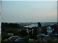
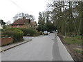
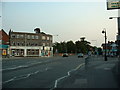
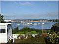

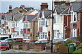
40 photos from this area
Area Information
Key information about the SO19 4EA including its size, population, and administrative classification.
- Area Type
- Postcode
- Area Size
- 1.5 hectares
- Population
- 1668
- Population Density
- 5407 people/km²
House Prices in SO19 4EA
26
Properties
£268,677
Average Sold Price
£89,950
Lowest Price
£570,000
Highest Price
Showing 26 properties
| Address | Type | Beds | Baths | Last Sale Price | Last Sale Date | |
|---|---|---|---|---|---|---|
| 22 Bitterne Way, Southampton, SO19 4EA | Detached | 6 | 4 | £570,000 | Jul 2017 | |
| 48 Bitterne Way, Southampton, SO19 4EA | house | - | - | £297,500 | Mar 2016 | |
| 36 Bitterne Way, Southampton, SO19 4EA | Detached | 4 | 3 | £535,000 | Nov 2014 | |
| 4 Bitterne Way, Southampton, SO19 4EA | Detached | - | - | £391,000 | Sep 2013 | |
| 30 Bitterne Way, Southampton, SO19 4EA | house | - | - | £269,000 | Nov 2009 | |
| 14 Bitterne Way, Southampton, SO19 4EA | Detached | - | - | £250,000 | Mar 2009 | |
| 42 Bitterne Way, Southampton, SO19 4EA | Detached | - | - | £260,000 | Dec 2006 | |
| 6 Bitterne Way, Southampton, SO19 4EA | Detached | - | - | £280,000 | Oct 2005 | |
| 24 Bitterne Way, Southampton, SO19 4EA | Detached | - | - | £230,000 | Jun 2005 | |
| 32 Bitterne Way, Southampton, SO19 4EA | Detached | - | - | £235,000 | Jul 2004 |
Page 1 of 3
Energy Efficiency in SO19 4EA
Amenities
Schools
| Rank | School | Type | Entry gender | Ages |
|---|
Explore more schools in this area
Go to Schools tabDemographics
Household Size
Family (3-5 people)
most common
Accommodation Type
Houses
most common
Tenure
82
majority
Ethnic Group
White
most common
Religion
N/A
most common
Household Composition
N/A
most common
Age
47
median
Adults (30-64 years)
most common
Household Deprivation
N/A
with no deprivation
NS-SEC
40
in Lower managerial occupations
Explore more demographic insights in this area
Go to Demographics tabPlanning
Planning Constraints
- Flood RiskPremium
- Ramsar Wetland SitesPremium
- Area of Outstanding Natural BeautyPremium
- Protected Nature ReservePremium
- Protected WoodlandPremium