Area Overview for SO19 2FB
Photos of SO19 2FB
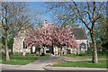

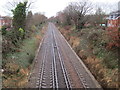
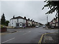
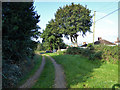
66 photos from this area
Area Information
Key information about the SO19 2FB including its size, population, and administrative classification.
- Area Type
- Postcode
- Area Size
- 9120 m²
- Population
- 1652
- Population Density
- 9198 people/km²
House Prices in SO19 2FB
37
Properties
£216,844
Average Sold Price
£50,000
Lowest Price
£330,000
Highest Price
Showing 37 properties
| Address | Type | Beds | Baths | Last Sale Price | Last Sale Date | |
|---|---|---|---|---|---|---|
| 48 Bishops Road, Southampton, SO19 2FB | house | - | - | £246,000 | Apr 2023 | |
| 58 Bishops Road, Southampton, SO19 2FB | Terraced | 3 | 1 | £255,750 | Dec 2022 | |
| 60 Bishops Road, Southampton, SO19 2FB | house | - | - | £329,000 | Jun 2022 | |
| 56 Bishops Road, Southampton, SO19 2FB | Terraced | 3 | 1 | £290,000 | Mar 2022 | |
| 36 Bishops Road, Southampton, SO19 2FB | house | 2 | - | £241,000 | Sep 2021 | |
| 18 Bishops Road, Southampton, SO19 2FB | house | - | - | £330,000 | May 2021 | |
| 2A Bishops Road, Southampton, SO19 2FB | Detached | 3 | 2 | £310,000 | May 2021 | |
| 20 Bishops Road, Southampton, SO19 2FB | house | - | - | £277,500 | Nov 2020 | |
| 70 Bishops Road, Southampton, SO19 2FB | house | 3 | 1 | £242,000 | Jun 2020 | |
| 54 Bishops Road, Southampton, SO19 2FB | Terraced | 3 | 1 | £210,000 | Mar 2019 |
Page 1 of 4
Energy Efficiency in SO19 2FB
Amenities
Schools
| Rank | School | Type | Entry gender | Ages |
|---|
Explore more schools in this area
Go to Schools tabDemographics
Household Size
Family (3-5 people)
most common
Accommodation Type
Houses
most common
Tenure
72
majority
Ethnic Group
White
most common
Religion
N/A
most common
Household Composition
N/A
most common
Age
47
median
Adults (30-64 years)
most common
Household Deprivation
N/A
with no deprivation
NS-SEC
30
in Lower managerial occupations
Explore more demographic insights in this area
Go to Demographics tabPlanning
Planning Constraints
- Flood RiskPremium
- Ramsar Wetland SitesPremium
- Area of Outstanding Natural BeautyPremium
- Protected Nature ReservePremium
- Protected WoodlandPremium