Area Overview for SO19 2FX
Photos of SO19 2FX


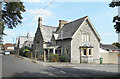
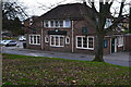
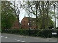

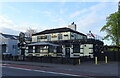

66 photos from this area
Area Information
Key information about the SO19 2FX including its size, population, and administrative classification.
- Area Type
- Postcode
- Area Size
- 4505 m²
- Population
- 1463
- Population Density
- 7047 people/km²
House Prices in SO19 2FX
14
Properties
£175,417
Average Sold Price
£52,000
Lowest Price
£357,500
Highest Price
Showing 14 properties
| Address | Type | Beds | Baths | Last Sale Price | Last Sale Date | |
|---|---|---|---|---|---|---|
| 63 Millais Road, Southampton, SO19 2FX | Semi-detached | 4 | 1 | £357,500 | Oct 2022 | |
| 85 Millais Road, Southampton, SO19 2FX | house | - | - | £210,000 | May 2021 | |
| 79 Millais Road, Southampton, SO19 2FX | house | - | - | £240,000 | Feb 2019 | |
| 65 Millais Road, Southampton, SO19 2FX | Detached | 4 | 1 | £210,000 | Jan 2019 | |
| 81 Millais Road, Southampton, SO19 2FX | Semi-detached | - | - | £180,000 | Jul 2014 | |
| 83 Millais Road, Southampton, SO19 2FX | Semi-detached | 3 | 2 | £173,000 | Oct 2013 | |
| 69 Millais Road, Southampton, SO19 2FX | Semi-detached | - | - | £226,500 | Aug 2007 | |
| 67 Millais Road, Southampton, SO19 2FX | house | - | - | £174,000 | Apr 2007 | |
| 61 Millais Road, Southampton, SO19 2FX | Semi-detached | - | - | £167,000 | Mar 2004 | |
| 87 Millais Road, Southampton, SO19 2FX | house | - | - | £52,000 | Jul 1997 |
Page 1 of 2
Energy Efficiency in SO19 2FX
Amenities
Schools
| Rank | School | Type | Entry gender | Ages |
|---|
Explore more schools in this area
Go to Schools tabDemographics
Household Size
Family (3-5 people)
most common
Accommodation Type
Houses
most common
Tenure
70
majority
Ethnic Group
White
most common
Religion
N/A
most common
Household Composition
N/A
most common
Age
47
median
Adults (30-64 years)
most common
Household Deprivation
N/A
with no deprivation
NS-SEC
30
in Lower managerial occupations
Explore more demographic insights in this area
Go to Demographics tabPlanning
Planning Constraints
- Flood RiskPremium
- Ramsar Wetland SitesPremium
- Area of Outstanding Natural BeautyPremium
- Protected Nature ReservePremium
- Protected WoodlandPremium