Area Overview for SO19 2FD
Photos of SO19 2FD

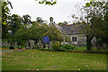
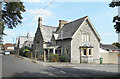
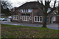
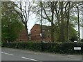
66 photos from this area
Area Information
Key information about the SO19 2FD including its size, population, and administrative classification.
- Area Type
- Postcode
- Area Size
- 5882 m²
- Population
- 1463
- Population Density
- 7047 people/km²
House Prices in SO19 2FD
30
Properties
£164,179
Average Sold Price
£10,000
Lowest Price
£265,000
Highest Price
Showing 30 properties
| Address | Type | Beds | Baths | Last Sale Price | Last Sale Date | |
|---|---|---|---|---|---|---|
| 63 Bishops Road, Southampton, SO19 2FD | Terraced | 3 | 1 | £258,000 | Jun 2023 | |
| 59 Bishops Road, Southampton, SO19 2FD | Terraced | 3 | 1 | £231,000 | Jan 2020 | |
| 49 Bishops Road, Southampton, SO19 2FD | Semi-detached | 3 | 1 | £265,000 | Nov 2017 | |
| 51 Bishops Road, Southampton, SO19 2FD | house | - | - | £187,500 | Sep 2014 | |
| 69 Bishops Road, Southampton, SO19 2FD | Terraced | 3 | 1 | £195,000 | Apr 2014 | |
| 61 Bishops Road, Southampton, SO19 2FD | house | - | - | £160,000 | May 2013 | |
| 67 Bishops Road, Southampton, SO19 2FD | house | 3 | - | £170,000 | Jan 2012 | |
| 55 Bishops Road, Southampton, SO19 2FD | Terraced | - | - | £167,000 | Feb 2007 | |
| 41 Bishops Road, Southampton, SO19 2FD | Semi-detached | 1 | 1 | £150,000 | Aug 2006 | |
| 75 Bishops Road, Southampton, SO19 2FD | Detached | 3 | - | £165,000 | Apr 2006 |
Page 1 of 3
Energy Efficiency in SO19 2FD
Amenities
Schools
| Rank | School | Type | Entry gender | Ages |
|---|
Explore more schools in this area
Go to Schools tabDemographics
Household Size
Family (3-5 people)
most common
Accommodation Type
Houses
most common
Tenure
70
majority
Ethnic Group
White
most common
Religion
N/A
most common
Household Composition
N/A
most common
Age
47
median
Adults (30-64 years)
most common
Household Deprivation
N/A
with no deprivation
NS-SEC
30
in Lower managerial occupations
Explore more demographic insights in this area
Go to Demographics tabPlanning
Planning Constraints
- Flood RiskPremium
- Ramsar Wetland SitesPremium
- Area of Outstanding Natural BeautyPremium
- Protected Nature ReservePremium
- Protected WoodlandPremium