Area Overview for SO16 8AN
Photos of SO16 8AN
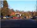
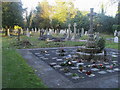
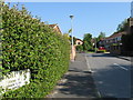
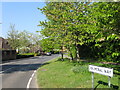
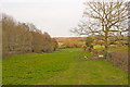
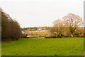

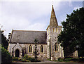
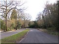


68 photos from this area
Area Information
Key information about the SO16 8AN including its size, population, and administrative classification.
- Area Type
- Postcode
- Area Size
- 8.4 hectares
- Population
- 1819
- Population Density
- 118 people/km²
House Prices in SO16 8AN
15
Properties
£604,364
Average Sold Price
£390,000
Lowest Price
£875,000
Highest Price
Showing 15 properties
| Address | Type | Beds | Baths | Last Sale Price | Last Sale Date | |
|---|---|---|---|---|---|---|
| Green Glade, Greenhill Lane, Rownhams, SO16 8AN | Detached | 5 | 2 | £862,000 | Feb 2021 | |
| Springfield, Greenhill Lane, Rownhams, SO16 8AN | Bungalow | 2 | 1 | £473,000 | Dec 2019 | |
| Littlecroft, Greenhill Lane, Rownhams, SO16 8AN | Bungalow | - | - | £520,000 | Oct 2017 | |
| Cottlestone, Greenhill Lane, Rownhams, SO16 8AN | Bungalow | - | - | £555,000 | Apr 2017 | |
| Burn Brae, Greenhill Lane, Rownhams, SO16 8AN | house | 5 | - | £663,000 | Dec 2015 | |
| Linwood Cottage, Greenhill Lane, Rownhams, SO16 8AN | Bungalow | - | - | £470,000 | Nov 2015 | |
| Fairfield, Greenhill Lane, Rownhams, SO16 8AN | Bungalow | 5 | - | £745,000 | Feb 2015 | |
| Redthorn, Greenhill Lane, Rownhams, SO16 8AN | Bungalow | 3 | - | £400,000 | Aug 2014 | |
| Bracken, Greenhill Lane, Rownhams, SO16 8AN | Bungalow | 3 | - | £390,000 | Jun 2007 | |
| Greenhills, Greenhill Lane, Rownhams, SO16 8AN | Detached | - | - | £875,000 | Apr 2004 |
Page 1 of 2
Energy Efficiency in SO16 8AN
Amenities
Schools
| Rank | School | Type | Entry gender | Ages |
|---|
Explore more schools in this area
Go to Schools tabDemographics
Household Size
Two person
most common
Accommodation Type
Houses
most common
Tenure
86
majority
Ethnic Group
White
most common
Religion
N/A
most common
Household Composition
N/A
most common
Age
47
median
Adults (30-64 years)
most common
Household Deprivation
N/A
with no deprivation
NS-SEC
45
in Lower managerial occupations
Explore more demographic insights in this area
Go to Demographics tabPlanning
Planning Constraints
- Flood RiskPremium
- Ramsar Wetland SitesPremium
- Area of Outstanding Natural BeautyPremium
- Protected Nature ReservePremium
- Protected WoodlandPremium