Area Overview for SO16 8AP
Photos of SO16 8AP


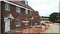
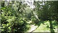
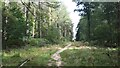
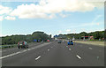
30 photos from this area
Area Information
Key information about the SO16 8AP including its size, population, and administrative classification.
- Area Type
- Postcode
- Area Size
- 70.1 hectares
- Population
- 1819
- Population Density
- 118 people/km²
House Prices in SO16 8AP
38
Properties
£456,861
Average Sold Price
£82,500
Lowest Price
£875,000
Highest Price
Showing 38 properties
| Address | Type | Beds | Baths | Last Sale Price | Last Sale Date | |
|---|---|---|---|---|---|---|
| Skyline, Rownhams Lane, Rownhams, SO16 8AP | Detached | 4 | 3 | £875,000 | Aug 2022 | |
| Barleycorn, Rownhams Lane, Rownhams, SO16 8AP | Detached | 4 | 2 | £590,000 | Aug 2022 | |
| Avalon, Rownhams Lane, Rownhams, SO16 8AP | Retail | 5 | 1 | £680,000 | May 2021 | |
| Autumn View, Rownhams Lane, Rownhams, SO16 8AP | Detached | 3 | 1 | £395,000 | Nov 2020 | |
| Inshallah, Rownhams Lane, Rownhams, SO16 8AP | house | - | - | £560,000 | Oct 2020 | |
| Woodridge, Rownhams Lane, Rownhams, SO16 8AP | Detached | 3 | 1 | £450,000 | Jun 2020 | |
| Blandings, Rownhams Lane, Rownhams, SO16 8AP | Detached | 4 | 3 | £665,000 | Apr 2020 | |
| Kammez, Rownhams Lane, Rownhams, SO16 8AP | Detached | 4 | - | £550,000 | Dec 2017 | |
| 1, Chilworth View, Rownhams Lane, Rownhams, SO16 8AP | Semi-detached | 3 | - | £290,000 | May 2013 | |
| Meadow View, Rownhams Lane, Rownhams, SO16 8AP | Detached | 6 | - | £565,000 | Apr 2012 |
Page 1 of 4
Energy Efficiency in SO16 8AP
Amenities
Schools
| Rank | School | Type | Entry gender | Ages |
|---|
Explore more schools in this area
Go to Schools tabDemographics
Household Size
Two person
most common
Accommodation Type
Houses
most common
Tenure
86
majority
Ethnic Group
White
most common
Religion
N/A
most common
Household Composition
N/A
most common
Age
47
median
Adults (30-64 years)
most common
Household Deprivation
N/A
with no deprivation
NS-SEC
45
in Lower managerial occupations
Explore more demographic insights in this area
Go to Demographics tabPlanning
Planning Constraints
- Flood RiskPremium
- Ramsar Wetland SitesPremium
- Area of Outstanding Natural BeautyPremium
- Protected Nature ReservePremium
- Protected WoodlandPremium